Windham
|
|||
Windham |
When I picked Roy up at the train station in New Jersey, it was already getting dark. Roy and I had been hiking together less lately since he had moved to Maryland, but we still tried to get together once in a while. This weeken's plan was to climb the last three peaks I needed for the 3500 club: Windham, Halcott, and Kaaterskill High Peak.
I brought Rosie along again, because she did well on the last trip. On that trip, the collar had caused some chafing on her neck, so this time I had her in a harness. I thought it would be more confortable, would help her get tangled in the leash less, and would be more secure.
 |
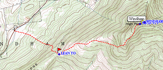
We would start with Windham, because I had read that the trail to the lean-to was wide
and easy to follow. The moon was setting as we arrived at the trailhead, just after
11:00 PM. The sky was clear and the temperature was perfect, so we set off with
great energy. Before we got past the trail register, Rosie proved that she could
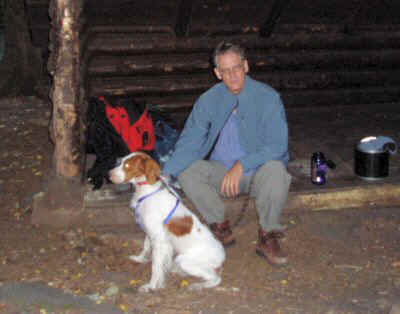
escape from the harness, but sh also showed that she would come back, so we proceeded on. The trail was indeed wide, easy to follow, and not too steep. We made quick progress to the junction. We turned left, followng the sign to the lean to, but missed it in the dark. We doubled back and spread out, and finally found it. It did not take us long to get to bed. Roy stayed in the lean-to while I set up my hammock a few feet away. As before, I tied Rosie to a nearby tree, where she curled up and watched everything. I could hear footsteps, faintly, off and on during the night. Every time I check Rosie, she was alret and staring off into the darkness. I assumed that I was hearing porcupines. At about 4:30 the footsteps were closer, and Rosie was standing up ad straining against the leash. A few minutes later, when I checked again, she was gone and the harness was on the ground. I got up and called her, and in a few seconds she came to me. Whew! I was not sure she was going to come to me, or chase a porcupine, or run away. I think she was trying to get away from the porcupine. I tried attaching her more securely, and tried to get back to sleep. I don't think either of us really got any more sleep that night. The next morning, we ate a quick breakfast, left our packs at the lean to, and headed up to the peak. |
| At Windham Lean To |
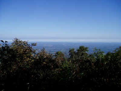
| We made quick progress up the ridge, and arrived at the peak and its two viewpoints before long. The views, both to the north and south, were spectacular. Off to the north, we could just barely see a big city: skyscrapers, smokestacks belching smoke, etc. Closer by, farms spread out in the flatlands below. On the south side were the peaks of the Dome Range: Blakchead, Black dome, and Thomas Cole. | 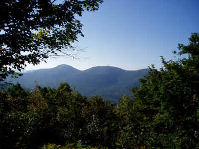 |
| View South from Windham |
 |
After a quick snack at the peak, we descended back to the lean to. On the way down, we passed several parties headed up. We picked up our packs and headed back down to the trailhead, passing several additional parties. |
| View North from Windham |
| Next on the agenda was Halcott. I had considered climbing it each trip this summer, but I have always passed it by for something more attractive. Now it was time to just do it. We parked at the pull out near the top of the pass, followed a short trail to the base of a waterfall, then struck off on our own through vast fields of stinging nettles and increasingly steep slopes. Rosie was not happy: she would not willingly hop over fallen trees, and finally just lay down on the ground. After a couple minutes and some encouragement, she agreed to go on again. that did not last long, and again she simply lay down. She was not panting, and did not appear to be tired at all. Maybe it was the nettles, or maybe she simply did not like being off the trail. Whatever, we could not go on this way. Once we turned back and started down the hill she was a lot happier, and made it back without any trouble. She still did not seem to be tired, just uncooperative off-trail, so we decided to give the Kaaterskill High Peak trail a try. |
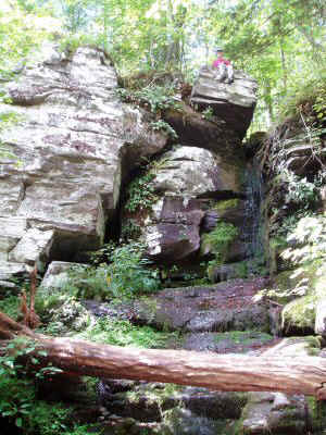 |
| Falls near Halcott Trailhead |
 |
||
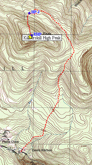
Kaaterskill High Peak |
| The High Peak trail is actually a snowmobile trail most of the way, meaning it is flat
enough and wide enough to drive a snowmobile up. It starts out ascending steeply,
but then this moderates and it ascends gently for several miles. It even descends
gently fr a mile or so, before making an abrupt turn and ascending straight up the last
600 feet of High Peak. This section reminded me of the north face of Blackhead in
its directness, and the steepness of the rock ledges. The summit is in a tiny
clearing. Nearby is a crankshaft and a piece of aircraft. I explored a bit,
looking for either of the two viewpoints shown on the map, or for the rest of the
aircraft, but I did not find ether one. There did seem to be a trail heading
south. Rosie was back to her usual self on the trail, walking beside me most of the way. It is hard for me to tell what she is thinking -- she is so well behaved, so undemonstrative. She just walks along, alert to what is going on, but otherwise just going along with things. |
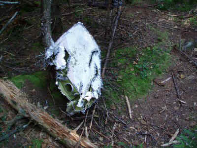 |
| Fragment of Aircraft on Kaaterskill High Peak |
| Lean To | N42 18.386 | W74 10.423 |
| Windham South Viewpoint | N42 18.874 | W74 8.672 |
| Windham North Viewpoint | N42 18.896 | W74 8.575 |
| Windham actual peak | N42 18.895 | W74 8.580 |
| Kaaterskill Peak Junction | N42 10.047 | W74 4.889 |
| Kaaterskill Peak | N42 9.726 | W74 4.830 |