On the Catskill 3500 yahoo group, there has been some discussion of a crash on Panthr Mountain, but no one had been to visit it. As a result of my queries, I was able to contact someone who had visited the crash many years ago, and he described its gneral location. I had been planning to try to find it last fall, but I had to postpone due to snow. Finally this week I had a chance to try again.
|
On Friday, I drove up in the morning and warmed up by hiking up to the crash on Van Wyck. On an earlier hike, I had failed to locate the lower crash site, and had eventually given up and hiked on to the upper site. This time I wanted to find the lower site. |
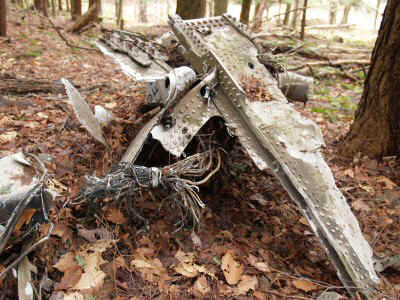
| Tail |
| Equipped with GPS coordiates, it was simple to find. The front half of the plane is pretty much gone. Only the tail and engine are recognizable. | 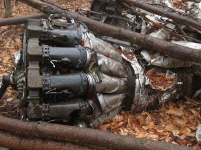 |
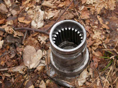
| Jet Engine |
 |
The front half of the plain was all scattered abount in little pieces. |
| Engine Close Up |
|
Panther Mountain Crash Site |
The next day I moved over to the Panther crash. I had gotten permission to hike up Little Peck Hollow, through a gun club's property. No one was around, perhaps because it rained all day yesterday, and it looked pretty threatening today too.
| I headed
up a jeep road, past one clearing and then another. At the second clearing, the
state land begins. There is a clear trail from the second clearing up the ridge,
marked with ugly orange paint on trees every few feet. The orange paint gives way
eventually to orange ribbons, then peters out. After a slight rise in the slope of
the ridgeline I arrived at the area of the wreck. Now I had to find it. I started zigzagging along the slope, working my way down little by little. After leaving the ribbon-marked path, I did not see much sign of disturbance. After an hour or so I was getting discouraged, but I moved in an ever larger spiral. I had been told that there was not mcu to see, and that it might be covered by a modest snowfall. Finally, I came upon a tiny sliver of metal poking through the leaves. A few feet away, another buried piece. I found it! I explored around, but did not find anything else for a while. Then I came across a few more pieces, and then more, and then lots and lots of pieces, large and small. |
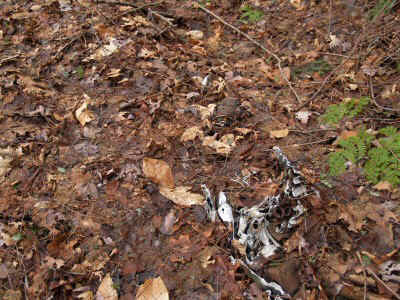 |
| First Bit Of Debris |
 |
There were more pieces, scattered over a larger area, than any other crash I have been to. This plane, a two-engine military jet, must have hit pretty hard, because it (1) scattered pieces over a very large area, and (2) left so few large pieces. |
| Cindy |
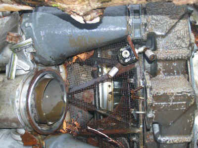
| After visiting a few of these crashes, I am starting to see some similarities. Every site has three recognizable features: the engine(s), the landing strut, and cockpit instruments. These seem to be the only really heavy, durable pieces on a plane. I am beginning to picture an aircraft as a fragile shell, like an egg. There is a light framework, with even lighter skin attached. | 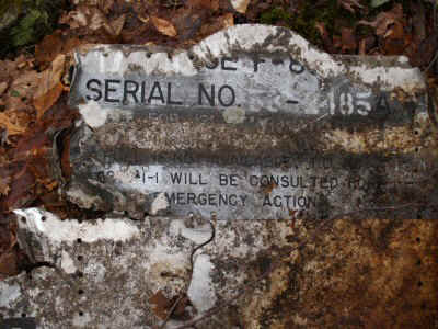 |
| Debris |
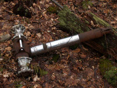 |
The landing strut is really strong and heavy, and never breaks up in a crash. |
| Landing Strut |
| The engine or engines are usually right in the middle of the debris field, smashed up but in one piece. It seems like when the framework hits something it just shatters, and the skin just shreads. | 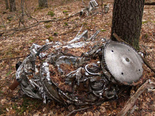 |
| One Of The Engines |
 |
Then there are lots of miscellaneous pieces that look like they could have come right from the factory. |
| Perfectly Preserved Piece of ??? |
After looking around for a while, I headed back down the ridge. Back at the saddle (the upper clearing), I decided to descend via Hatchery Hollow.
I headed due north, as the slope gradually descended gently. I was clearly entering the canyon shown on the map, which would lead inevitably to the road. In a few minutes, I thought I detected the remnants of a very old trail. There seemed to be a flattened sections of ground along the west side of the ravine. The former trail was covered by many downed trees and saplings of considerable size growing up through it. But the signs were unmistakable -- there had been a path here at one time. I wonder where it went?
I tried to follow, but as the slope became steeper I lost and regained the trail several times. Eventually I would give up searching and move on, and then the trail would show up again. Moving farther downstream, the width became greater and greater, almost a carriage road.
I started to see the property line on the other side of the stream, so I knew I was getting close to the road. Finally, I saw houses. The last little bit of the route squeezes down to a very narrow public access way right on the stream bank. But you don't ever have to cross the stream.
After reaching the road, I had to walk several miles back to the car, but I got to see Olivera along the way. Not many people out -- I guess the threat of rain kept people away this weekend.