Sierra Trip 93 -- Rae Lakes with Ben and Nathan
Overview
You can jump directly to points in the trip by clicking on the map above.
You can download the TOPO! source file to see
more detail in the maps.
You can view the raw pictures here.
In 1993 I had taken Carrie, Eva, and Roy with me to the Sierras. Now it was the
older brothers' turn: Ben and Nathan. We planned a more ambitious goal: the boys
were 15 whereas the girls had been only 12. Our objective was to hike up Bubbs Creek
to East Creek, cross Longley Pass, and climb Mt. Brewer. From there, we would return
via Cloud Canyon. The trip we actually made was much different, but no less
memorable.
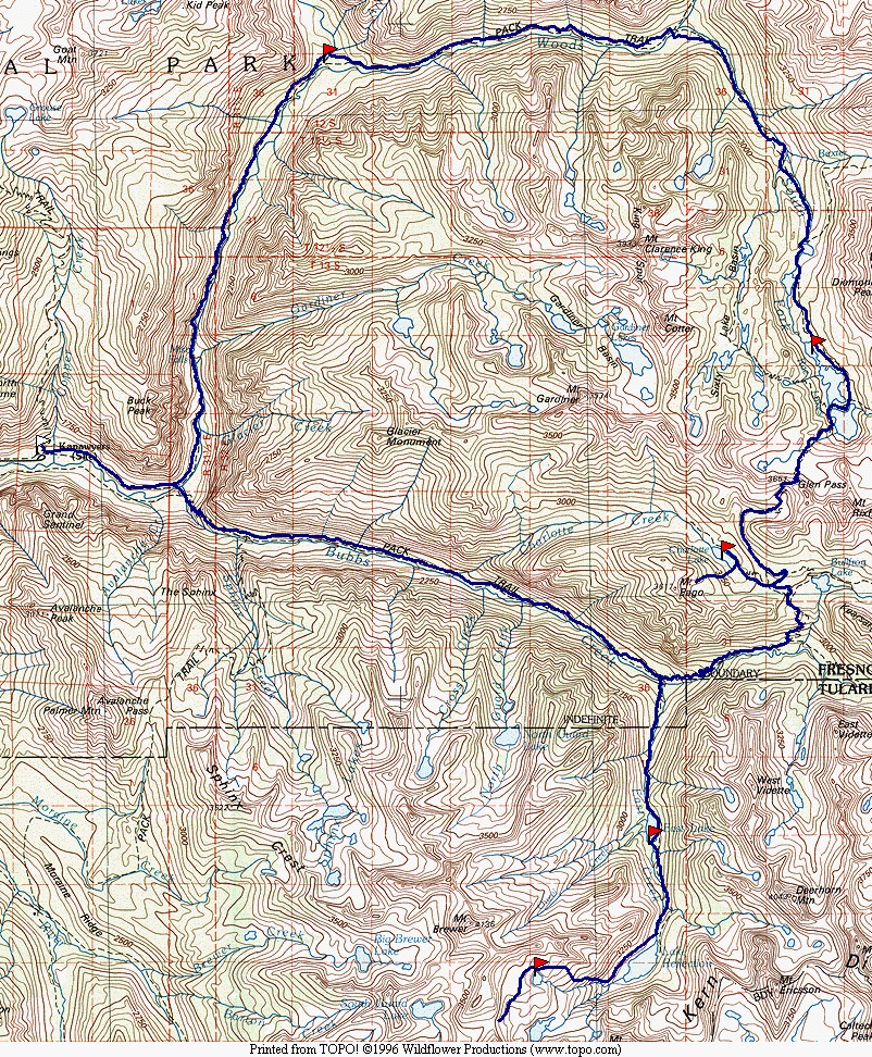
Map 1 -- Cedar Grove to Charlotte Lake
|
|
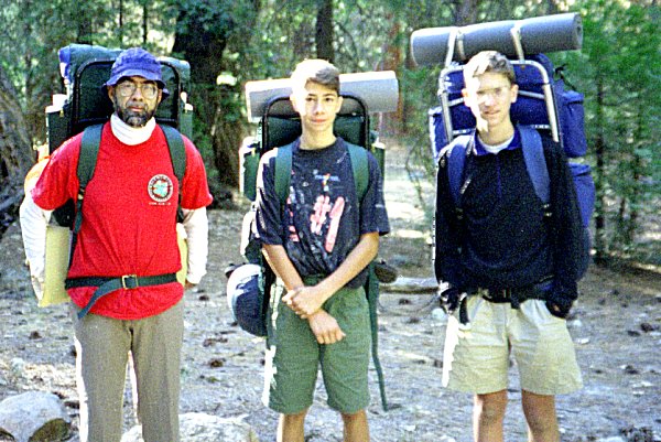
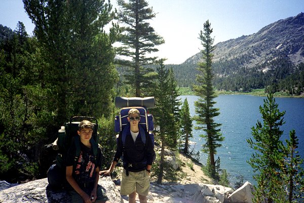
We spent the night at the Cedar Grove campground, and got an early start the next day.
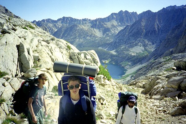
Here we are, all clean and fresh, set to go. |
| Roy, Nathan, and Ben at Cedar Grove |
|
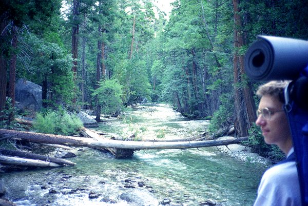
| Bubbs Creek would be a formidable crossing, if it were not for the bridge. |
|
|
Bubbs Creek |
|
|
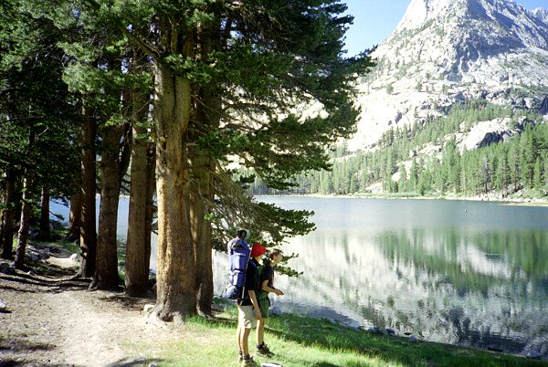
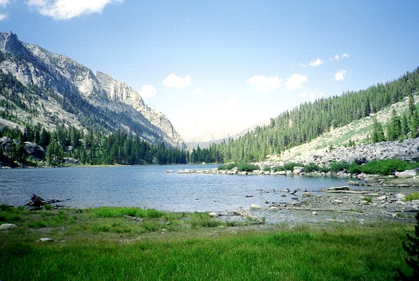
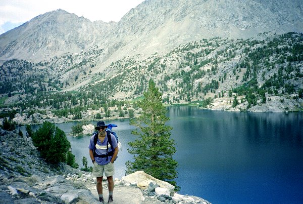
The boys were fast hikers, and we had no trouble making it to East Lake (shown here)
and beyond to Reflection Lake the first day. I have made this hike myself several
times, but I did not remember it as so long or as so tiring. We saw a bear,
off in the distance, at Junction Meadow. We were sitting on a log eating lunch, and
it came to check things out a couple times. It ran off when it was us moving, so we
never felt threatened by it. After that, we did not see another bear. |
| Ben and Nathan at East Lake |
|
| The next day we left the trail and climbed toward Longley Pass. Here we are
resting, looking down at reflection Lake. |
|
|
Reflection Lake |
|
|
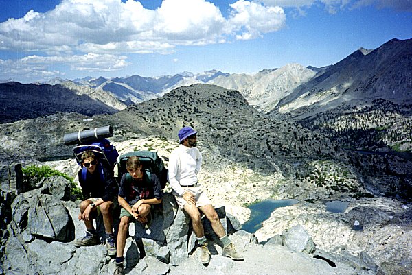
Progress slowed significantly, as we all began to feel the altitude and the cumulative
effects of exertion. I had hoped to make it over the pass from Lake Reflection in
one day. I remember doing that once before (but now I am not so sure).
Anyway, we were beat and camped beside a group of magnificent lakes, with the pass in
view. |
| Campsite above Reflection Lake |
|
| I have never before had trouble with blisters ... but there is always a first time.
I was wearing new boots, but I think it was the socks that were the cause of my
trouble. My feet hurt the first day, but I did not stop to do anything about it.
They hurt a lot the second day, as the steep climbing off-trail pressed the boots
against my tender blisters. I needed to spend a day off my feet. From camp, we
could see that Longley Pass was blocked by snow. I suggested that the others hike up
to the pass without their packs and scout out whether it would be possible to bypass the
snow. |
|
|
Campsite above Reflection Lake |
|
|
The weather was clear and warm, perfect for exploring the upper basin. Also
perfect for puttering around the lake and napping while my feat healed. |
|
|
| When Roy and the boys reached the pass, they found it was covered completely by a snow
cornice, overhanging several feet and about 20 feet high. They could not see a way
around it -- it extended over the whole flat part of the pass to the cliffs on either
side. They reluctantly concluded the route was impassible. |
|
|
Longley Pass |
|
|
I was not surprised that they found a cornice. I had heard that this happens
from time to time, and it certainly looked like a cornice from camp. We decided to
return to Bubbs Creek and try Glen Pass and the Rae Lakes loop. |
| Longley Pass from Campsite |
|
| The next day we all headed back down toward East Creek. My feet were much
happier walking down hill, and the rest helped as well. |
|
|
Reflection Lake |
|
|
Our progress downhill was much faster than up, and we made it to East Lake in a couple
of hours, as opposed to a whole day going up. |
| East Lake |
|
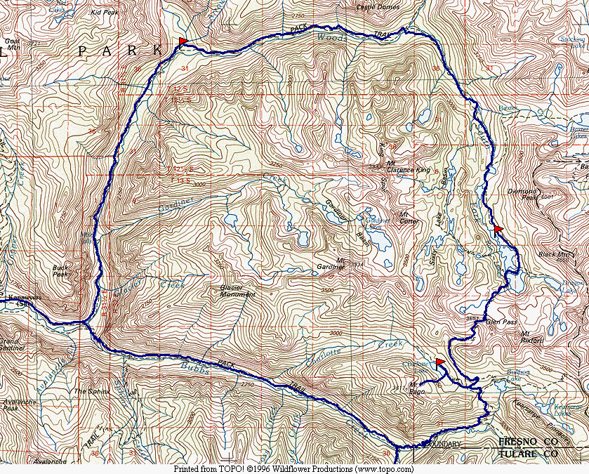
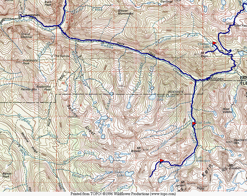
Map 2 -- Charlotte Lake to Rae Lakes and Cedar Grove
|
|
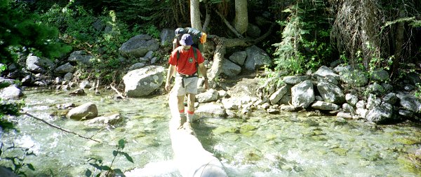
After descending East Creek, we crossed Bubbs Creek and headed up the canyon toward
Junction Meadow. The stream was pretty high, and we were grateful that we could find
a log to cross. |
| Crossing Bubbs Creek |
|
| Lead by the speedy boys, we quickly reached Junction Meadow and headed on up toward
Charlotte Lake. We got there in mid-afternoon, and found no one else camped there.
We picked a good campsite and all lay down and napped after a long day of hiking. |
|
|
Charlotte Lake |
|
|
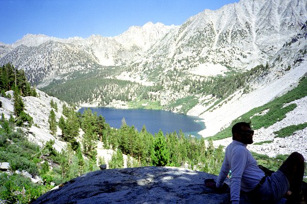
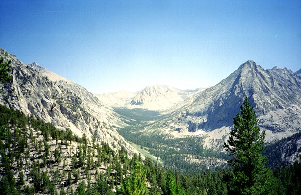
The next day we retraced our steps up to the trail junction, and headed for Glen Pass.
This is the last view of upper Bubbs Creek, looking in the direction of Forrester
Pass. |
| Upper Bubbs Creek from Glen Pass |
|
| And this is the first view of the Rae Lakes Basin. None of us had ever been in
this vicinity before, but we had heard about how beautiful it was. It did not
disappoint us. We met many parties on the Glen Pass trail, and had to share the
pass with a dozen people and a train of mules carrying supplies for a party of two
photographers. The clouds passing overhead cast shadows over the terrain below, so
that it was constantly changing in appearance. It was much more dramatic than I
could capture on film. |
|
|
Rae Lakes from Glen Pass |
|
|
As we descended, the clouds thickened, so that by the time we neared the first lake it
was beginning to threaten rain. We all broke out our rain gear, but we had to
continue hiking because every campsite was occupied. |
| Charlie at Rae Lakes |
|
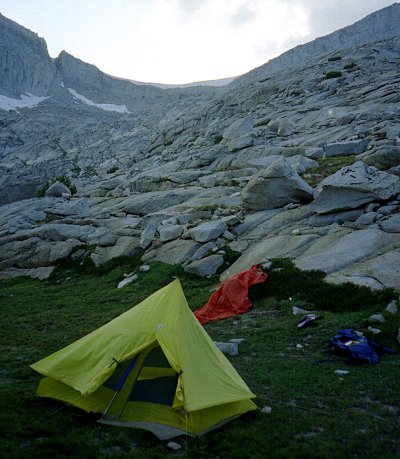
| We hiked several miles in an increasing rain, passing site after site claimed by other
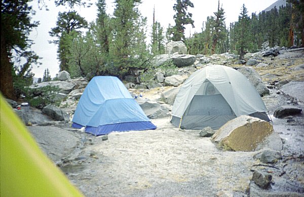
parties. Finally, at the northernmost of the Rae Lakes we found a site, near a bear
box, that was free. As we began setting up our tents, it rained harder and harder,
with thunder and lightning crashing around us. We crawled in our tents as the rain
turned to sleet and hail. This picture does not show it very clearly, but the
ground was covered in a layer of ice pebbles.
Eventually the clouds blew over, and we were able to cook out of the rain. |
|
|
Hailstorm Aftermath |
|
|
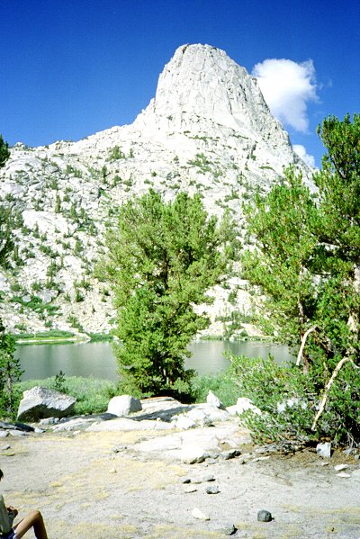
The next morning it was bright and clear. We could hardly see Fin Dome across
the lake yesterday, but not it stands towering overhead. |
| Fin Dome |
|
| We passed Arrowhead and Dollar Lakes, as we proceeded down the canyon. At dinner
time last night we met a woman with two small children, looking for the ranger's cabin.
We looked around and found the cabin, but not the ranger. She told us she was
worried that she had heart problems ! |
|
|
Dollar Lake |
| We were happy to see the woman and her kinds the next morning, apparently OK. We
offered to keep an eye on her as she hiked out. She was grateful, saying she still
thought she might be having a heart attack. Even though we were hiking pretty fast,
she was going even more quickly, and did not stay close enough to us that we could have
done any good. We caught up to her and her kinds a couple of times, but they always
raged off again. |
|
|
South Fork Woods Creek |
|
|
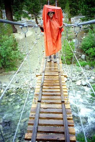
The clouds again thickened, and it began to rain. Crossing the suspension bridge
at Woods Creek Junction was exciting because it was slippery in the rain. But it was
definitely better than having to cross the stream, which was quite high. We kept on
going down Woods Creek, through the rain, to Paradise Valley. It was still raining
when we reached the campground, so we set up our tents and cooked in the rain.
Descending Woods Creek, we were passed by several parties of trail runners ! They
had on shots, tee shirts, and fanny packs of water. I could not get one of them to
stop long enough to talk, but I gathered they were doing the 60 miles Rae Lakes loop in
one day. I wish I were in good enough shape to do that. On the other hand,
what is the point of being in the wild if you mere hurry past it ? |
| Ben at Woods Creek Crossing |
|
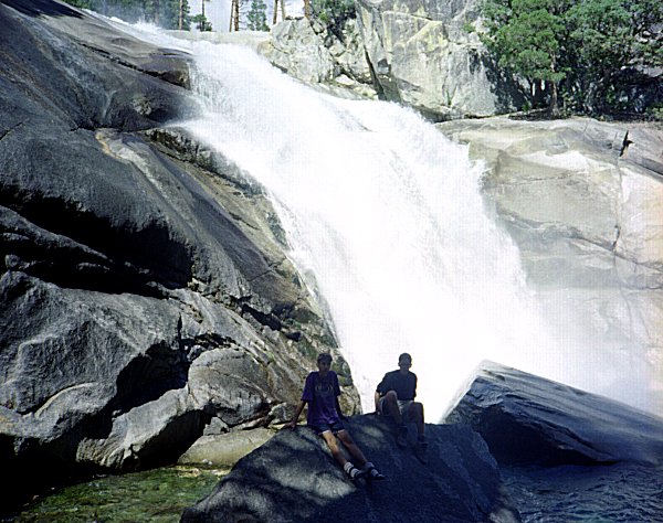
| The morning was again dry and clear, so we hurried to get going. We made great
time going down hill, stopping only to rest and enjoy Mist Falls. |
|
|
Mist Falls |
|
|
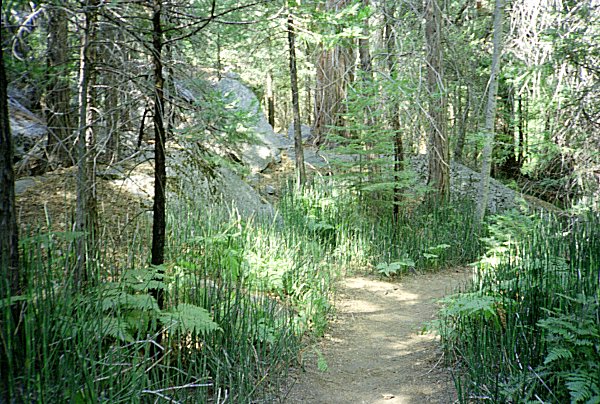
At the bottom of Bubbs Creek there is a charming area overgrown with a bamboo-like
plant that I have seen nowhere else in the park. I wish I know what it was, and why
it is here and nowhere else. It is oasis of shade on an otherwise hot, dry trail. |
| Near junction of Woods Creek and Bubbs Creek |
|
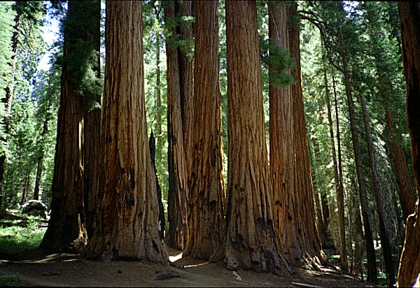
| We arrived in Cedar Grove early in the afternoon, and decided to drive over to the
Sequoia groves in the other part of the park. We all enjoyed the usual tourist
sights: the groves of giant trees, Moro Rock, warm showers, etc. Although we did not
achieve our initial objective, it was a wonderful trip through beautiful territory,
fulfilling everyone's expectations. |
|
|
Giant Sequoia Grove |
 Go
back to Charles Hayden's Home Page
Go
back to Charles Hayden's Home Page
cchayden@gmail.com