Sierra Trip 87 -- Ferguson Canyon
You can download the TOPO! source file to see
more detail in the maps.
You can see all the raw photos here.
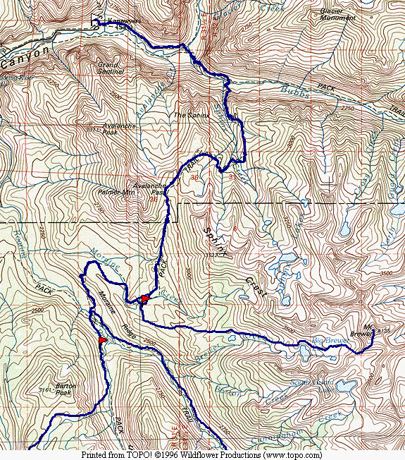
Map 1 -- Cedar Grove to Deadman Canyon
Mt Brewer
Cloud Canyon to Cedar Grove
Because bus service from Fresno to SEKI was discontinued in 1986, I had to rent a car
in Fresno and drive up to the park. This has been an extra expense, and gives both
more and less flexibility (since I have to return to the car). It will eliminate any
further adventures at the airport or on the trip to the park.
The focus of this trip was to explore Ferguson Canyon. I have looked down the
canyon from the Tablelands, and have spoken to backcountry rangers about it. One
ranger told me that it was one of the most little-used areas of the park, that only a few
groups go in there every year. My plan is to enter the canyon at the bottom and
emerge at the Tablelands. A loop from Cedar Grove through Ferguson Canyon, looping
back through Cloud or Deadman would give me the opportunity to make another attempt on Mt.
Brewer, if conditions are right.
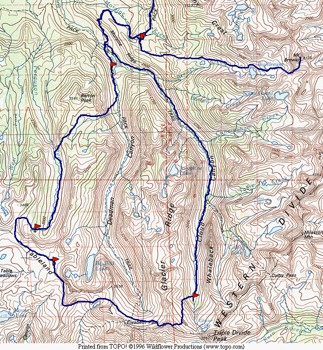
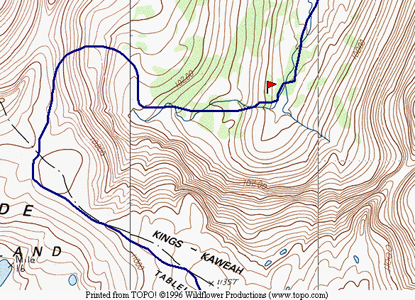
Map 2 -- Ferguson and Cloud Canyons
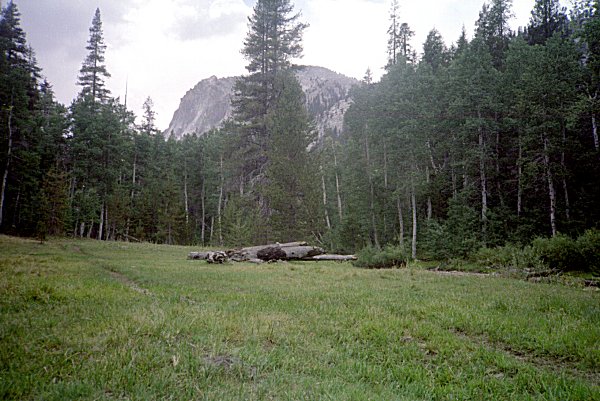
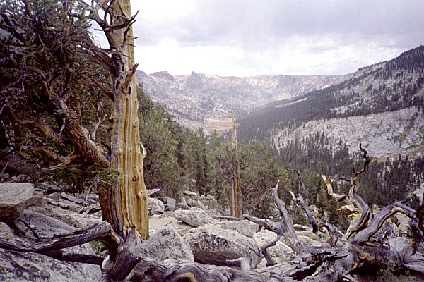
| The trip from Cedar Grove over Avalanche Pass was unremarkable. Passing Roaring
River and heading up Deadman Canyon, I began to see the canyon wall I planned to climb to
get into Ferguson Canyon. |
|
|
Barton Peak |
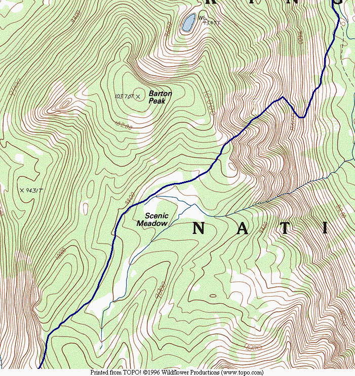 |
I planned to pass Palmer Mountain, climb up out of Deadman Canyon, pass through Scenic
Meadow, and head down into Ferguson Canyon. |
Route From Deadman Canyon to Ferguson Canyon |
|
|
|
The climb up the canyon wall was steep and long, but it was through wooded terrain,
and whenever it got too steep for me to walk, I could grab onto a tree or bush and pull
myself up. As I approached the top of the steepest part, I was rewarded with a
view back towards Sphynx Crest |
Roaring River -- Deadman Canyon West Wall |
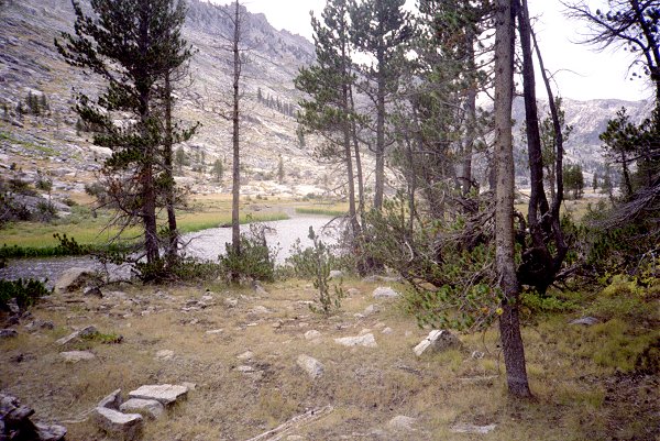
|
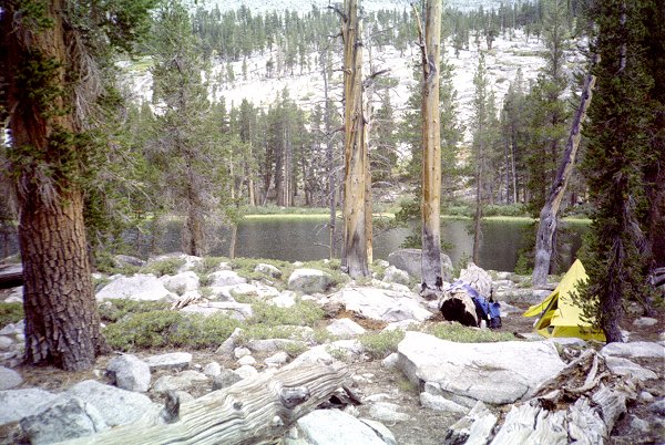
| The maps do not show a lake, only a stream. But I found this charming lake to
camp near, in the vicinity of Scenic Meadow. |
|
|
Scenic Meadow Vicinity |
|
|
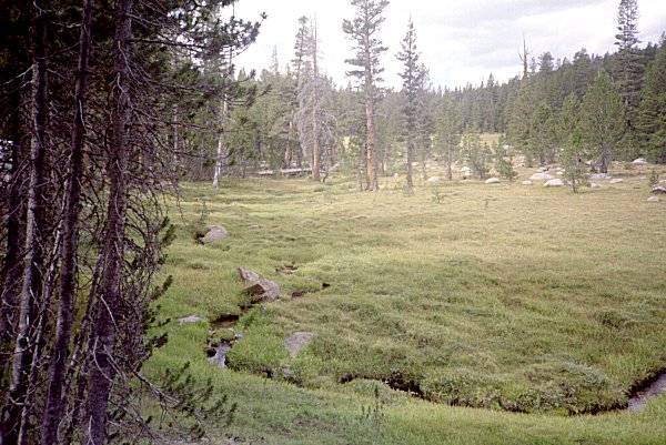
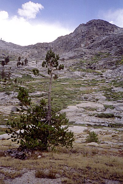
The meadow was steeply sloping in most places, but opened out occasionally to reveal
the mountains around. This was very pleasant hiking, a good place to be as I finally
lost my compulsion to hurry along. |
Scenic Meadow |
|
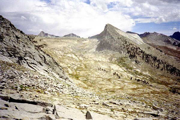
| This was my first glimpse of Ferguson Canyon, as I passed through the gap south of
Barton Peak. I could see all the way up the canyon, to its head. The
Tablelands lay beyond. You may notice the lack of blue skies, or even identifiable
clouds in many of these pictures. This is because the weather was mostly overcast,
threatening to rain all week. Other than a few brief showers, it did not rain until
much later. More on that in due time. |
|
|
Ferguson Canyon |
|
|
This is what Ferguson Canyon looks like. It was pristine, dry, with sparse tree
cover. It was relatively flat and easy strolling. |
Ferguson Canyon |
|
| The head of Ferguson Canyon steepens, as it approaches the Tablelands. As I
neared, it started raining lightly, so I got out the tent and took a siesta. When I
woke up later, the clouds had departed I left my camp set up, and explored ways to get
out of the canyon. I could not tell for sure from the maps how hard it would be, but
I managed to find an easy route to the top, going to the right of the little knob here. |
|
|
Ferguson Canyon |
|
|
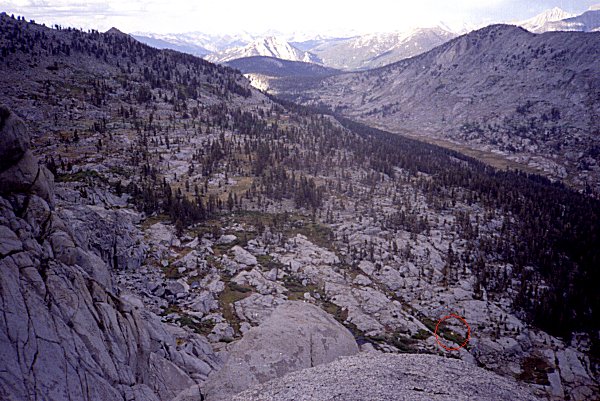
This shows Ferguson Canyon from above. The canyon is in deep shadow, for the sun
is near the horizon. The saddle that I cam over is in the middle distance, with
Barton Peak to its left in sunlight. My tent is about one pixel wide in this photo, in
the red circle. |
| Ferguson Canyon from above |
|
The route up Ferguson Canyon headwall
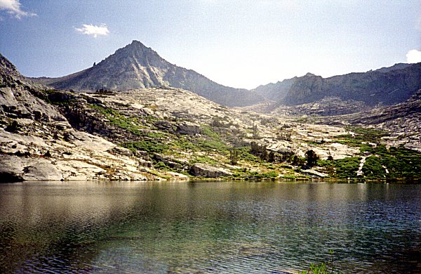
| Once on the Tablelands, I followed the ridge, passing my favorite lake above Big
Bird. From there, I headed to Pterodactyl Pass. |
|
|
East from Pterodactyl Pass |
|
|
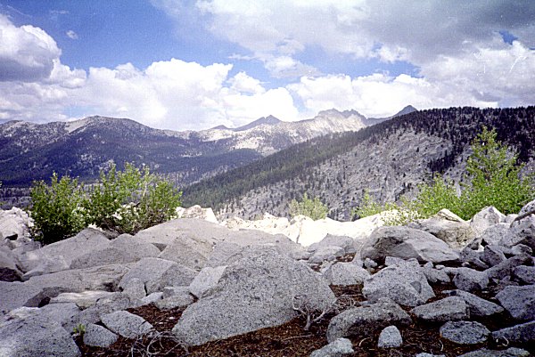
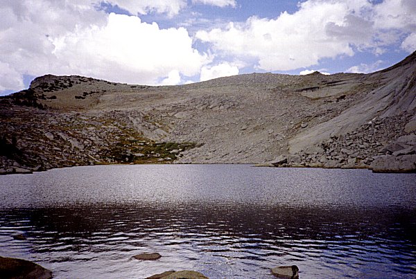
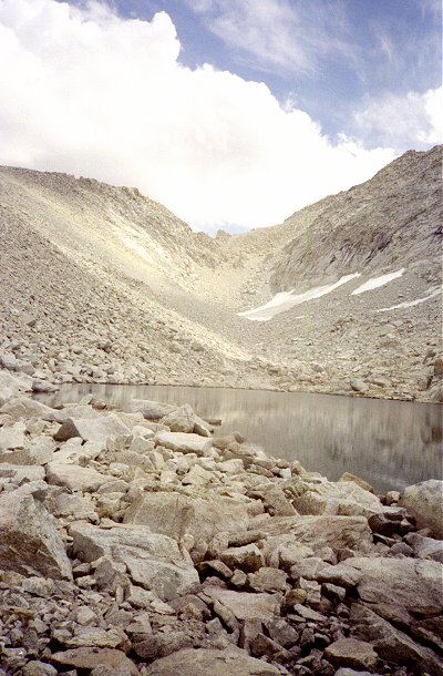
Then I headed to Lonely Lake. The view here is looking east, toward Deadman
Canyon and Elizabeth Pass. |
| Lonely Lake |
|
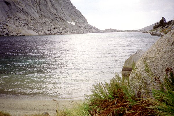
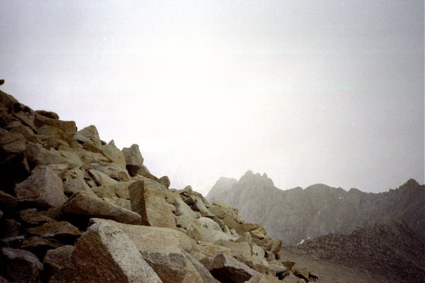
| Looking west, the wind and the impending storm are evident. Nevertheless, there
was no more than 10 minutes of light rain that day. |
|
|
Lonely Lake |
|
|
From Lonely Lake, I crossed into upper Deadman Canyon, skirted around its head, and
climbed up to the copper mine. From there, the Coppermine Pass trail (visible to the
far left just below the ridgeline) provides a spectacular crossing into Cloud
Canyon. The best part of this trail is how it affords great views of deep valleys
on both sides. This is Lion Lake and the Kaweah Peaks Ridge. |
| Lion Lake from Coppermine Pass |
|
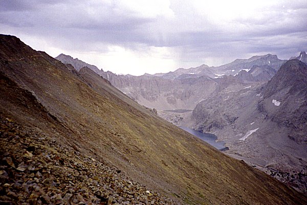
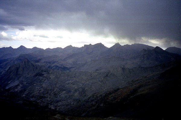
| I had thought about attempting Triple Divide Peak, but the storm clouds that enveloped
it quickly put that idea out of my mind. This view of the Great Western Divide, with
Milestone Mountain to the right of center, give some hint of what it looked like in the
middle of the afternoon. I headed directly down to the floor of Cloud Canyon, and camped
at the old miner's camp. Again, despite all the clouds, I saw scant precipitation. |
|
|
Milestone Mountain |
|
|
After heading down Cloud Canyon, I followed the trail up to Moraine Meadows.
From there, I headed along Moraine Ridge a half mile or so and made camp. I was
determined to climb Mt. Brewer from there the next day. I got up in the early morning
twilight, fixed a hasty breakfast, and headed up the ridge. As I passed Big Brewer
Lake and my high point from my previous attempt, I was feeling confident. It
was still early, the weather was clearer than it had been all week. and I was feeling
strong.
This shows Mt. Brewer and the route (to the left of the smaller tower) to the foot of
the peak. |
| Big Brewer Lake and Mt. Brewer |
|
| I reached the headwaters of Brewer Creek, the lake at the south face of Mt. Brewer by
noon. I had made up my mind to turn around at 2:00, so I still had a shot at
reaching the summit. Note that the clouds were building up but still looked benign. |
|
|
Headwaters Brewer Creek |
|
|
The weather would not hold for long, though. Soon clouds enveloped the
peak. As I reached the main ridgeline separating Brewer Creek from East Creek, I
realized that the other side of the ridge held much thicker clouds. These had been
blowing over the ridge and dissipating, but now grew thicker and thicker. I kept
ascending, more and more quickly. As I caught sight of the summit, no more than 50
feet away, thunder and lightning broke out and the hair on my arms began to stand on
end. As I pondered what to do next, I noticed little sparks coming off my fingers to
the rocks nearby, and a strange hissing sound.
I turned around and headed down as fast as I could go. What had taken me two
hours to ascend, I climbed down in fifteen minutes. As I arrived at the lake at the
foot of the face, the clouds blew away. How I wished I could climb back up, but by
now it was time to turn around. So close ... |
|
|
| When I reached my camp on Moraine Ridge, it was getting dark and I was
exhausted. It had rained off and on all the way back from the peak, and in my
absence some water had leaked into my tent through the floor. Everything was either
wet or damp, and I was too tired to make dinner, so I just lay down in the damp sleeping
bag and fell fast asleep. The next day as I checked out at the trailhead, I asked the
ranger about the storms that I had experienced all week. He said that they had not
seen a drop of rain there for 62 days running.
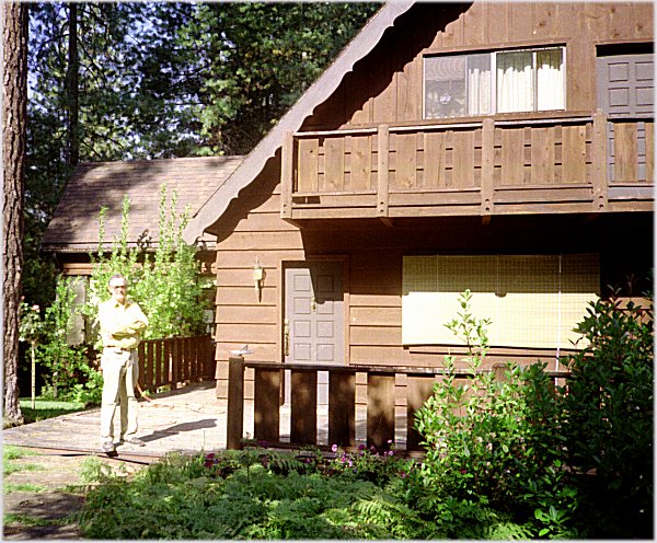
After I finished the trip, I paid a visit on Dennis James, a colleague who had retired
from Bell Labs in New Jersey to a cabin near Oakhurst, near Yosemite. He and his
wife fed and entertained me graciously, and let me dry out all my stuff (which was mostly
still wet). Thanks, Dennis. |
|
|
Dennis James |
 Go
back to Charles Hayden's Home Page
Go
back to Charles Hayden's Home Page
cchayden@gmail.com