Sierra Trip 78 -- Sugarloaf Creek
You can download the TOPO! source file to see
more detail in the maps.
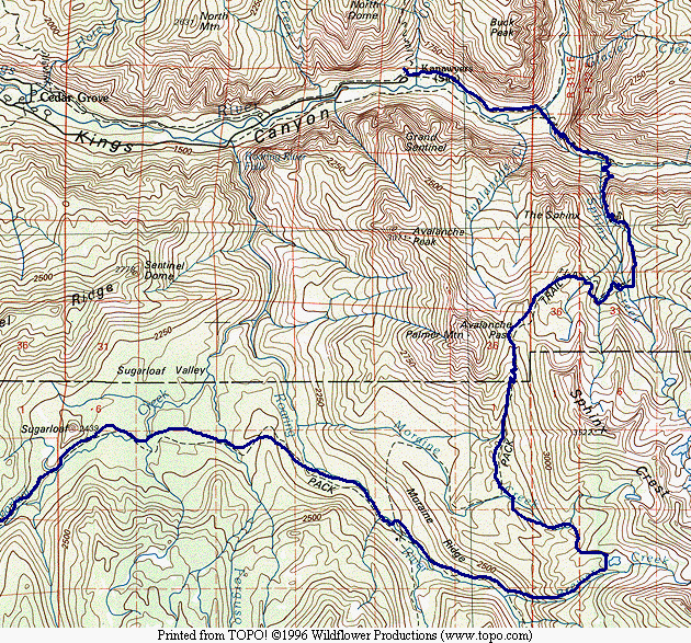
Map 1 -- Cedar Grove to Sugarloaf Valley
This trip, like others before, began with a flight from Los Angeles to Fresno and a bus
ride into Sequoia/Kings Canyon National Parks. The bus would not take me to Kings
Canyon, so I resolved to get off at Grants Grove and hitchhike. I had already
learned that the airlines would not let me take stove fuel, so I had purchased a new MSR
multi-fuel stove, and filled it up for the first time at a gas station in Grant Grove with
15 cents worth of unleaded regular.
I rarely hitchhike -- really only when backpacking. I am not cut out to survive
the trauma of so many people passing me by. I got a ride half way there, which put
me in the middle of nowhere as dusk set in. Luckily a group of German tourists
picked me up and took me the rest of the way to Cedar Grove. We shared a campsite,
and I paid them back by paying the camping fee.
The next morning I got up at the first sign of dawn and headed for the trailhead,
several miles down the road. A couple cars passed, and I only halfheartedly tried to
get a ride, but then a man in an old, beat-up Renault stopped for me. In doing so,
his car died, and he and I worked together (he under the hood, me behind the wheel) to get
it going again. This lead to him telling me how he and the car ware in a race to see
who would give out first. He had diabetes, and his sister was threatening to take
his car away from him, and going up into the mountains could well kill him. He was
planning to take part in a three-mile nature walk, which is where he was headed. If
he died attempting it, he would be happy to know he had died in his favorite place on the
earth. With these thoughts to ponder, we arrived at the trailhead parking lot, and
we bid goodbye.
| I set off with high hopes and lots of energy, but the climb out of Cedar Grove always
takes the energy out of me. It was sunny and hot, the trail dry, and the way steep. |
|
|
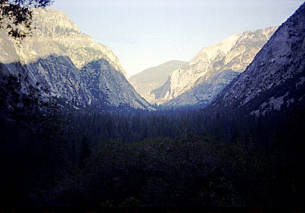
Kings Canyon in the early morning, as the sun
rises above the mountains |
|
|
Approaching Avalanche Pass, I stopped for lunch and a rest at one of the few green
spots.
On the first day, my tee shirt (and my skin) was still pretty white. |
| I had in mind another attempt on Mt Brewer. The
year before, I had been frustrated by forest fire. This time, I would approach
from the North. |
|
|
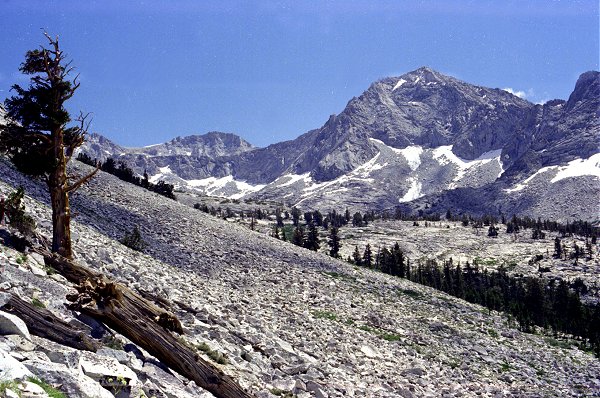
Mt Brewer from Avalanche Pass |
After spending the night near Avalanche Pass, I descended towards Moraine Ridge and set
off cross-country, trying to maintain altitude and contour towards Brewer Creek. In
these early days, I was still learning how to travel cross-country. The year
before, I had headed directly up the side of Cloud Canyon, an ordeal that I found
extremely tiring. So this time I vowed to maintain my elevation while hiking to the
South. The problem, as I was beginning to discover, was twofold. First, no one
strategy was right for all occasions: the terrain sometimes dictated maintain elevation,
and other times descending and ascending again was better. Second, as I would
eventually discover, hiking off-trail is inherently slower (and/or more tiring) than
hiking on the trail -- there is no way around it.
|
|
As I was still learning how much effort this was, and because I went up the canyon on
higher and steeper ground than necessary, I was getting alarmed at how slow and tiring my
progress was. I had hoped to ascent all the way to the foot of Mt. Brewer, and it
was becoming clear that I would not attain that. I also had to keep to my schedule
to make it back to Lodgepole at the appointed time. So I stopped at a beautiful lake
on the East slope of the canyon, north of Brewer Creek.. I had a memorable afternoon
sitting beside the lake. I saw frogs and fish in the water. I saw dozens
of delicate insects dragging themselves out of the water up on shore, drying their wings
in the sun, and taking off. I wondered what it must feel like to live beneath the
water, and then to come out into the air and take flight. |
The next day I had recovered some of my spirits, and decided to explore the route to
Mt. Brewer, as far as I could go in the time I had, in case I should ever come this way
again.
As I came into the side canyon formed by Brewer Creek, I finally realized how much harder
it was to travel high, instead of in the bottom of the canyon. |
|
|
|
I reached about three quarter of the way up Brewer Creek before I had to turn
back. I took careful note of the lay of the land, assessing the remaining
obstacles.
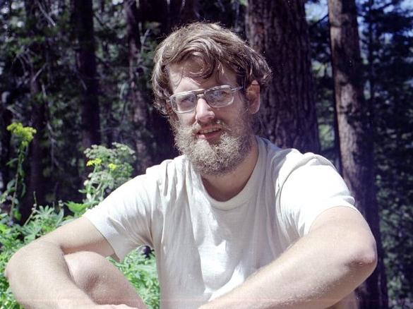
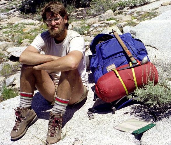
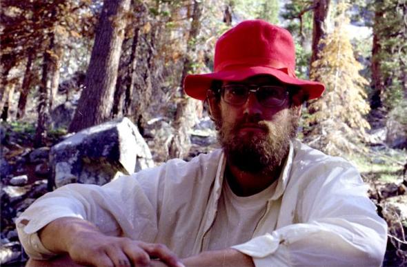
As I was resting, a couple of Park Service rangers passed by, on their way up toward Mt.
Brewer. I think each of us was equally surprised to se anyone in so remote an
area. The ranger took this picture for me. |
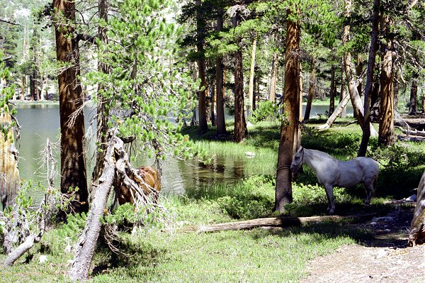
| At Big Brewer Lake I passed the rangers' pack animals. Apparently they had
ridden this far from Roaring River. |
|
|
|
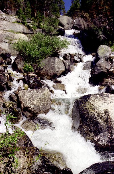
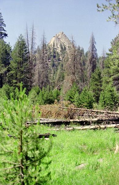
I followed Brewer Creek directly down to the floor of Cloud Canyon. It was
memorable in its steepness, and in the difficulty of getting through the brush at the
lower elevations. I made up my mind that I would use Moraine Ridge in the future, if
I were ever to ascend Brewer Creek again. |
Brewer Creek as it descends into Cloud Canyon |
|
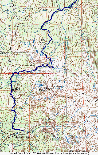
Map 2 -- Sugarloaf Valley to Lodgepole
Once I reached the trail, I had two choices for my route to Lodgepole: up Cloud
Canyon, over Coppermine Pass, and back through Elizabeth Pass or Pear Lake; or along
Sugarloaf Creek and through Silliman Pass.
Since I had already been through Coppermine Pass in both directions the year before, I
decided to explore the other route. |
|
|
Near Roaring River |
|
|
I enjoyed the lush colors of Sugarloaf Valley. The trail was level and wide, a
welcome respite from the steep and exhausting days just past.
I felt safer on the trail: at this point I was only confident enough to leave the trail
for a couple days at a time. Ironically, I saw no other hikers on the section of
trail from Roaring River through Silliman Pass, although I had encountered two rangers way
up Brewer Creek. |
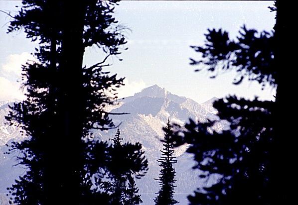
The Sugarloaf, from Sugarloaf Creek |
|
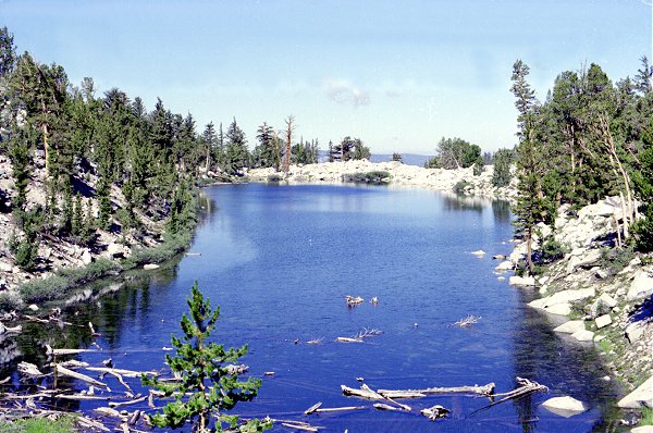
| I reached Lost Lake near the end of the day, after hiking all the way from Roaring
River. Soon after I went to sleep, I was awakened by the full moon rising in the
east. Its huge size and the great amount of light it shed startled me. I took
several pictures of it with my telephoto lens, but the results were disappointing -- all
black except for one tiny disk of nearly pure white about 5 pixels across. |
|
|
Lost Lake |
|
|
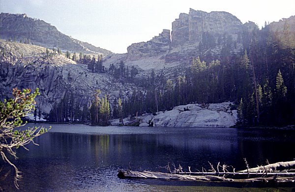
I got to do some more cross-country exploring travelling between Lost Lake and Ranger
Lake. This is Ranger Lake, with Mt. Silliman behind (the flat top, not the dome). |
Ranger Lake |
|
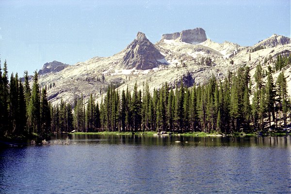
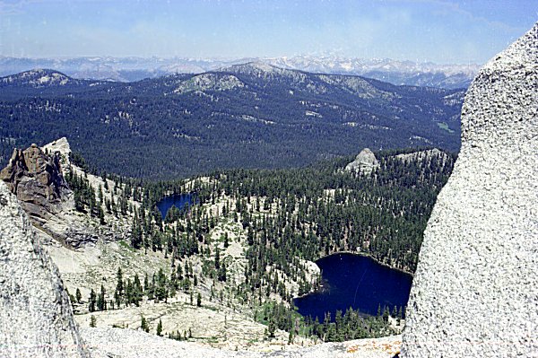
| I took a side trip from Silliman Pass to climb Twin Peaks. This shows a couple
of the lakes just below, plus Ball Dome and Sugarloaf Valley beyond. |
|
|
Lost Lake and companion, from Twin Peaks
|
|
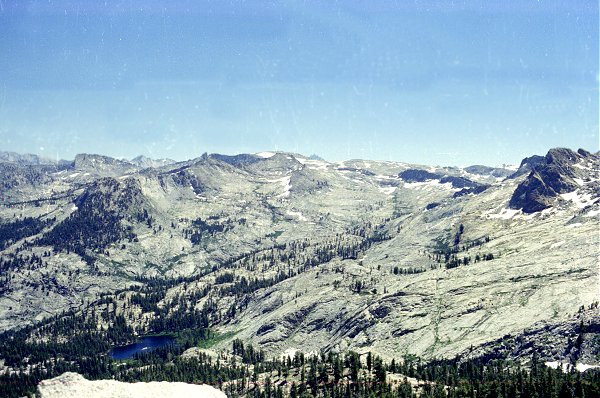
|
Looking the opposite direction, this shows Ranger Lake and Silliman Crest. When
I see such flat expanses of granite, I just long to explore them. |
Ranger Lake from Twin Peaks |
|
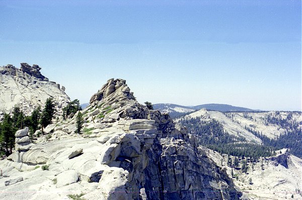
| This is the west side of Silliman Crest, looking south towards Lodgepole. My
return to Lodgepole via Twin Lakes and Cahoon Gap was pleasant and uneventful. |
|
|
Silliman Crest |
 Go
back to Charles Hayden's Home Page
Go
back to Charles Hayden's Home Page
cchayden@gmail.com