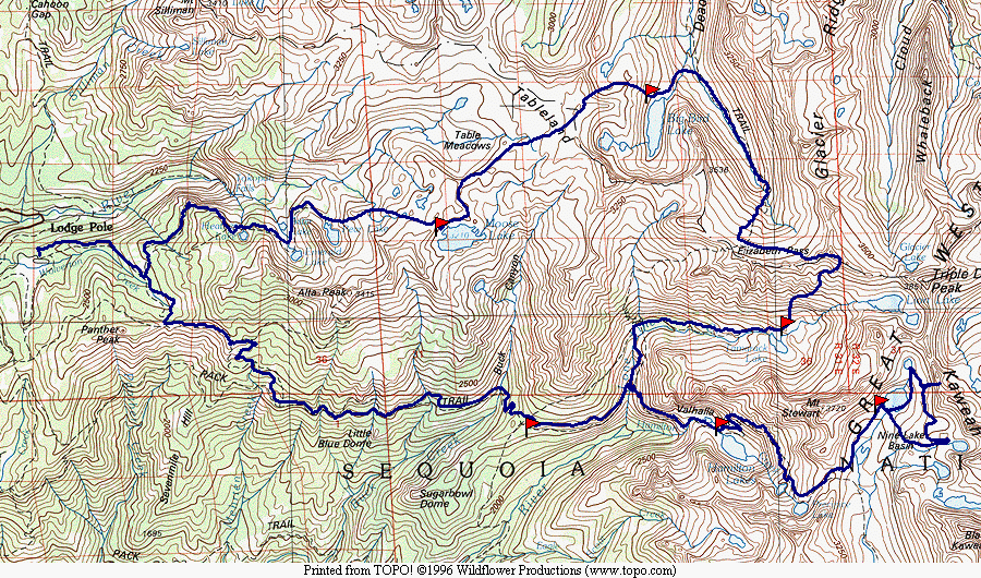
Trip Map
You can download the TOPO! source file to see more detail in the maps.
Trip Map
In a pivotal experience, I had hiked across the Sierras with my father and some other friends from the neighborhood as a teenager. We crossed from Whitney Portal to Crescent Meadow. But instead of taking the Pacific Crest Trail over Chagoopa Plateau, we made a sortcut up the Kern-Kaweah river and across Pants Pass. That tiny taste of off-trail hiking left me hungering for more. In 1976 I was in my early twenties, and ready to try it. My imagination was captured by the description of a trip to Moose Lake overland from Pear Lake in 100 Southern California Hiking Trails by Don and Roberta Lowe.
| As I started up the Pear Lake trail, it began to rain. I was well prepared. I had recently bought a decent tent, a light Sierra Designs two-man with a single "V" pole. (You will see it in the web pages from 1976 to 1997. Great tent.) I also had a poncho. With these two pieces of gear, I was confident. I saw dozens of parties heading out, so that when I arrived at Pear Lake I had the place to myself. It was raining steadily, and I stopped only briefly for a quick lunch before heading up the steep slope above Pear Lake. I had halfheartedly tried climbing above Pear Lake once before, and had turned around after only a few hundred feet in despair. This time I was resolved to make it, and I found the going easier. I continued, through intermittent rain, all the way to the ridge above Moose Lake. |
|
|
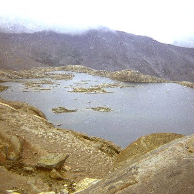
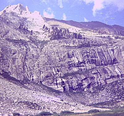
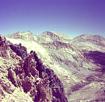
| Moose Lake from above |
|
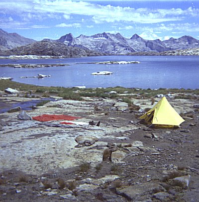
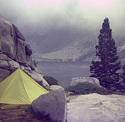
While I was making my way down to the lake shore, the rain began to change to sleet, and come down harder. I reached Moose Lake, struggled to set up my tent on a bare rock slab, and crawled in. I was pretty wet, and pretty cold. I lay and shivered for a while, tried to nap, and work up to the most glorious sight of blu sky with puffy white clouds above. | |
| Drying Gear at Moose Lake |
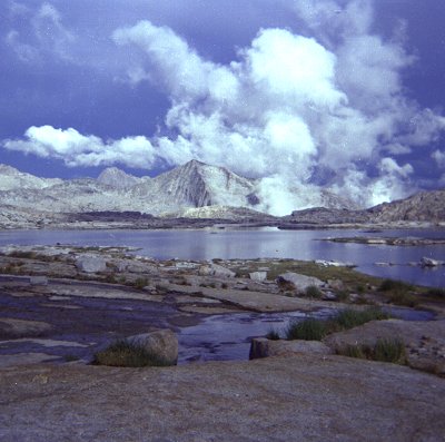
| I was fascinated by the way the clouds came up the canyon beyond the lake. One of the things that is striking about Moose Lake is how narrow the ridge between it and the canyon below it is. It looks like is poised on the edge of a cliff. I sat and watched the show for a long time before starting dinner preparations. |
|
|
| Moose Lake |
|
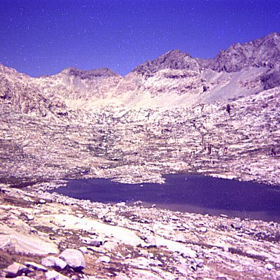
My next objective was to explore the Tablelands and to make my way toward Triple
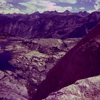
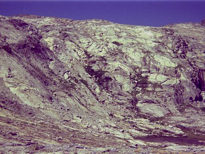
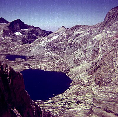
Divide Peak. If all went well, I wanted to try to climb it. I was intimidated by the Pterodactyl-Lonely Lake route to Elizabeth Pass, so I decided it wold be better to drop down to Big Bird Lake and rejoin the Elizabeth Pass trail. I bypassed the standard route down to Big Bird because i could not see most of the way from the ridge, and I did not want to get stuck partway down. I circled around to the northwest of Big Bird Lake and descended to a smaller lake there. On the map it was clear that if I could get tothis lake, I would be able to make it the rest of the way. The picture show this lake, from the ridge above. |
|
| Big Bird Lake Basin |
| The descent was harrowing -- much worse than I had anticipated. I was descending a steep gulley, which turned into a series of cliffs. I took the picture here to record the path of my descent. I want diagonally down from left to right, and wound up at the lake. It may not look like much, but there were several splace I descended that I could not have climbed back up, and the thought that I might be stuck on the side of a cliff is not conforting. I resolved never to get myself in such a situation again. |
|
|
| Route to Big Bird Lake |
|
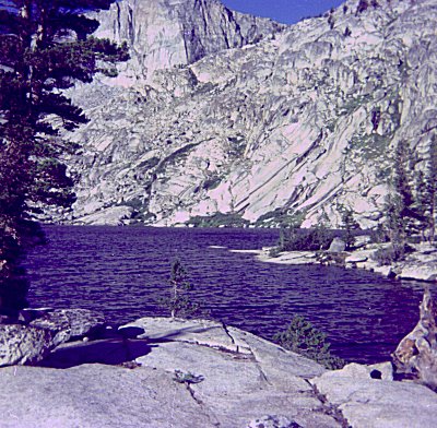
Once I arrived at Big Bird Lake the weather turned cooler and windy. I struggled to put my tent up in the wind. First the sleet, then a cold wind: this tent was coming in handy. I would have been miserable with my old, leaky, fragile A-frame. | |
| Big Bird Lake |
| The next day I descended all the way to the Elizabeth Pass trail, and hiked up to just
below the final switchbacks. Then I took off toward the coppermine. I stayed
as high as I could on the route, which I know now made it much harder. I remember
being tired and discouraged, although I know now to allow much more time for off-trail
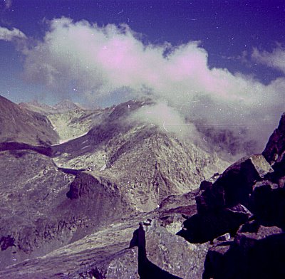
hiking. I visited the copper mine and ascended to the pass above it. There I found a bone. I don't have a picture, but it was a foot or two in length and several inches in diameter. It seemed to me that it could be a human thigh bone, and I wondered who had died up here. I did not know where the trail should be, so I hiked up the ridge to the east. Twenty minutes later I came across a pile of rocks containing a can with a note. It was mostly illegible. It loked like it had been scrawled with a very blunt pencil. The part I could read was like a farewell note from soneone injured and preparing to die. That, together with the bone, really spooked me. I reached the point on the route where I could see into Cloud Canyon, to Glacier Lake. I sat there ant studied the route for half an hour. I was worried about getting round the big black rock, shown here in the center, and about the part of the route that I could not see. After the experience at Big Bird Lake, and with the note fresh in my mind, I decided that I would look for a safer route. |
|
|
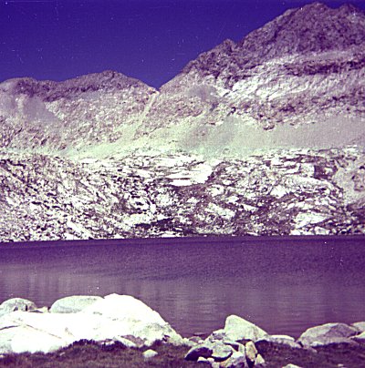
| Glacier Lake |
|
On the Coppermine Pass trail, the south slopes look much less steep than the north
ones. On the north the canyons end in cliffs, whereas on the south they are a
gradual talus slope. I reasoned that I could descend the easy slopes down to Tamrack
Lake, and hike out that way. I thought that I might even hike up to Lion Lake.
The first part of the descent was fun -- I was ready for some downhill. I could see Lion Lake and the area surrounding it. |
|
| Lion Lake from Coppermine Pass Route |
| The gradual sencent lasted only a short wile, and then the canyon wall started getting
steeper and steeper. I could see, by looking across the canyon, that there were
likely to be cliffs below me. I prayed that there would be some way down. Again I found myself stuck descending a series of little cliffs that I could probably not climb back up. On a number of occasions, I had to take my pack off to get down a crack, and then pull it down to me. I spent a lot of time walking back and forth along a horizontal step, looking for a way down to the next one. The picture here shows the gradul slopes way up above, where I started, and the final set of cliffs I had to descend to get to Tamrack Lake. I came by the grove of trees in the center, and then (somehow) descended the slopes below the trees to the canyon floor. This turned out to be much worse than Big Bird Lake, and I renewed my promise to myself never to do this again. I spent a long time thinking about slow-motion panic, and whether I had kept my composure, or whether I had acted too hastily in descending rather than turning around. |
|
|
| Route to Tamrack Lake |
| I spent the night at Tamrack Lake, and then descended to the Pacific Crest Trail, and headed up to Hamilton Lake. I was hiking into couds, but it only rained a tiny bit. I got to Hamilton Lake by lunchtime, but I was exhausted by the strain of the last few days, and just hung out near the lake the rest of the day. |
|
|
| Hamilton Lake |
|
The next day I ascended the trail, past the tunnel, past Precipice Lake, and up to
Kaweah Gap. I had passed this way many years before on the Trans-Sierra trip with my
father, and much of it had a conforting, familiar feel. I was glad to be back on the
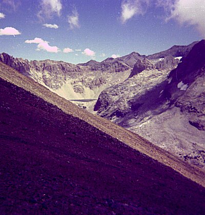
trail again. On that previous trip, we had crossed Pants Pass from east to west. I remembered that vividly, and wanted to see it again. Pants Pass is just to the left of center here, in an area where light and dark rock meet. I did not see how we could have crossed it. I descended into the basin, climbed up to one of the higher of the lakes, and made camp for the night. |
|
| Nine Lakes Basin |
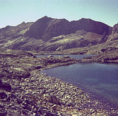
| The next day I left my camp in place and explored the basin. I wanted to see if I could visit all nine of the lake. This is one of the smaller of the lakes, with Lion Rock in the background. I never figured out which nine were the ones the basin was named after. |
|
|
| Nine Lakes Basin |
|
In the afternoon I decided to see if I could climb Pants Pass. Most of the way
up was just steep talus, but the last little bit was a very steep avalanche chute.
Nevertheless, without a heavy pack, and going up instead of down, it seemed pretty
safe. I was rewarded with a great view when I got to the top. The picture here shows the contrasting light and dark rocks at the pass, as well as some of the territory beyond. The route beyond the pass looked very steep, worse than what I had ascended. I did not think I would want to go down that. I was sure I would not go down, after what I had just been through. There was a big lake almost straight down. |
|
| Kern Kaweah from Pants Pass |
| Below on the other side I could see more of the lakes in the basin, as well as Triple Divide Peak and the areas beyond it. |
|
|
| Nine Lakes Basin from Pants Pass |
|
The descent back into Nine Lakes basin was much easier than the ascent. This picture shows the route to the pass. The chute is just the last little bit -- there is a lot of climbing involved to get there. But it was filled with relatively stable rocks that I could simply walk up like a staircase. Only the last 100 feet required my hands. | |
| Pants Pass from Nine Lakes Basin |
| The next day I descended to Bearpaw Meadow. I had made reservations to eat there
one night, and I really enjoyed the treat. After being alone for a week, I found
being around people energizing -- I wanted to talk and talk and talk. I ate two or
three helpings of everything they served. It was so good. I even got to take a hot
shower. The next day's descent seemed long and hot. I was sad to be leaving, disappointed not to have been able to climb Triple Divide Peak, but happy to have made it down some scary descents. On this trip Ihad pushed to my limits and beyond, and I had learned some important lessons. The most enduring lesson I learned was to stop and think, and to think again, when fear and nervous energy say to keep going. It is a lesson that is easy to remember but so hard to put into practice. |
|
|
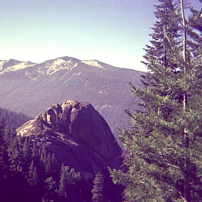
| Little Blue Dome |