 |
Mojave Desert from vicinity of Mt. Williamson
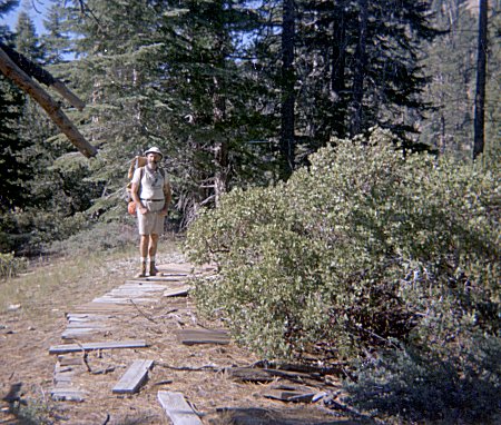
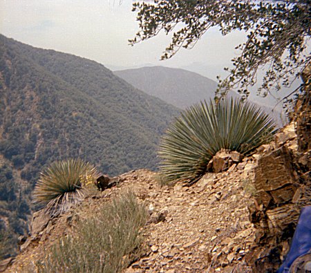
I went hiking with my father in the vicinity of Mt Williamson. We had a pleasant drive up into the mountains, listening to the Dodgers and the Yankees playing in the World Series. As I recall, Reggie Jackson hit a grand slam and the Dodgers lost.
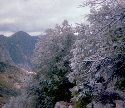
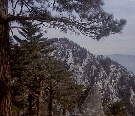
| The weather was unusually clear, with great views over the Mojave Desert. |
|
|
Mojave Desert from vicinity of Mt. Williamson |
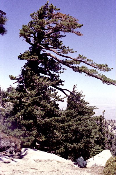
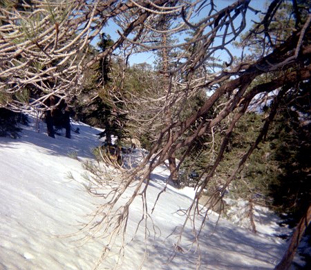
| The terrain was not especially steep, and there was little brush, so we decided to leave the trail and hike out along a ridge toward the desert. The trees along the ridgeline were deformed in interesting ways. |
|
|
Near Mt. Williamson |
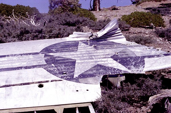
| Unexpectedly, we came across the site of an airplane crash. This had obviously
been there for many years, because bits of cloth, rubber, or other soft material were well
on their way to disappearing. Parts of the aircraft were scattered all around.
This was the largest intact piece -- part of a wing. Chris Killian has a web page on plane wrecks in these mountains, and believes this is a C119 that crashed in October 1966. |
|
|
Airplane Wing |
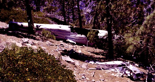
| Part of the main section of the plane was in one piece too. The items in the foreground are mostly more scraps of the plane. |
|
|
Airplane Body Section |
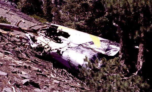
| This is the only other sizable piece of wreckage. There were some instruments and other items scattered about, and off down the hill were what looked like the remains of one of the engines. I could not see the other wing, or the cockpit. Actually there were thousands of scraps of metal, most of them the size of a fist or of a finger. I was surprised how fragile an airplane is, and how it breaks up into so many tiny pieces when it crashes. I imagined it would be more like a car wreck, where there is generally one mangled heap of metal. |
|
|
Another Airplane Body Section |
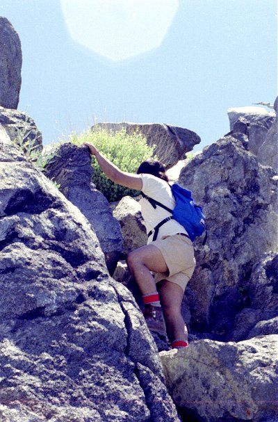
| I invited my officemate Tony Chiu to explore Strawberry Peak with me. I had been
up Strawberry Peak from Red Box (Robinson
hike 37) and I thought the great view and moderate elevation gain would be a good hike for
a less experienced hiker. For variety, I chose to ascend the other ridge, from Colby Canyon (Robinson hike 36). I neglected to read the trail description carefully: it turned out to be steeper and more strenuous than I had expected. We had a short stretch of class 2 climbing near the peak. |
|
|
Tony on the way to Strawberry Peak |
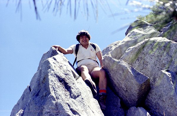
| The weather was spectacular, clear and warm. I remember Tony and talked about a
lot of graduate-student things. Later, our friendship was strained when my advisor went to war with Tony. But at this time we were close friends. |
|
|
Tony Chiu |
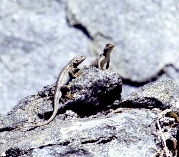
| We stopped and watched the lizards and the birds. When I am in the right kind of mood, I can watch lizards for hours. What a strange creature. I wonder what must be going through their minds. |
|
|
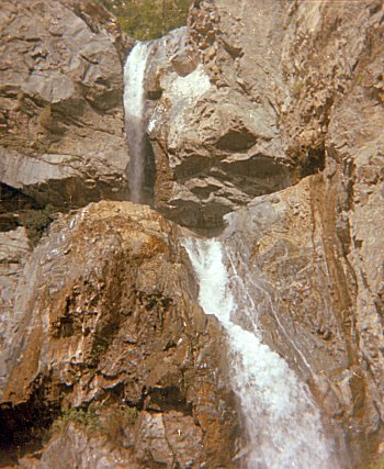
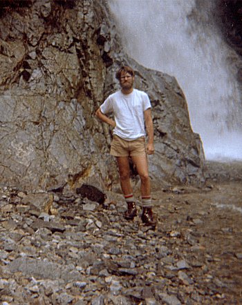
Fish Falls is a short hike, starting from the edge of the city (Robinson hike 48). This proximity has its drawbacks: I saw lots of spent ammunition cartridges, then heard incessant gunfire. It gave me pause. But I did not see anyone else, and eventually got far enough in that the feel of the wilderness came upon me. The reward is this beautiful waterfall. These pictures were taken in the spring, when the water flow is greatest.
| This is the upper part of the falls. I climbed part way up the opposite canyon wall to get this photo. |
|
|
Fish Falls |
|
I had my lunch at the base of the falls. Just as I was getting ready to leave, someone else came and I asked them to take a picture of me. | |
Fish Falls |
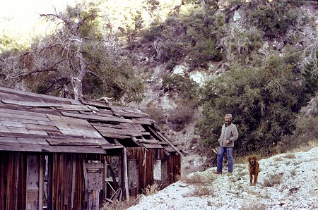
In Robinson's Mines of the San Gabriels, there is a description of the Mt. Gleason Mining District, which was active from 1888 through 1896. I went to the library and dug up some old Division of Mines reports on these mines. Armed with these sketchy descriptions, my father and I set off to see if we could find any signs of the mines.
| At least in 1978, there was an abundance of stuff left over from the mining days. There were several old shacks like this one, in varying states of disrepair. |
|
|
Mt. Gleason Mine Building |
|
Most of the mining equipment had been partly buried by erosion. This was just one of many large metal artifacts scattered around the site. | |
Mt. Gleason Mine Equipment |
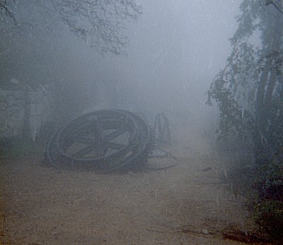
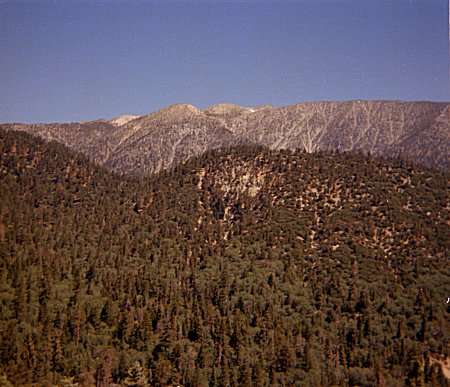
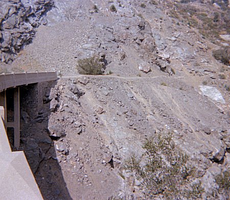
Mt Lowe is in the lower elevations of the front range. I learned through experience to visit the area in the cooler season, especially when it is overcast I climbed the Sam Merrill trail to Echo Mountain and Mount Lowe and descended Idlehour trail to the Mount Wilson Toll Road. This is described in Robinson, hike 28.
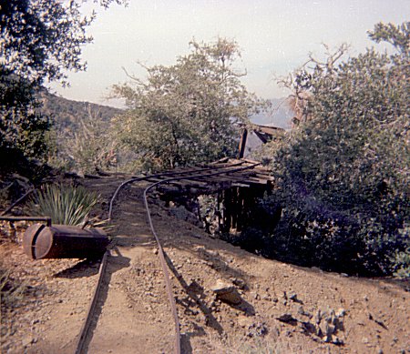
| Echo Mountain was the site of a resort hotel. It had a railway leading up to the
hotel site. Parts of the rail route are still visible on the hillside. At the
top, some of the machinery has been preserved. On this particular day, the city below was covered by low clouds. I hiked up into the clouds. This picture shows how thick the clouds were. |
|
|
Echo Mountain Railroad Equipment |
|
As I ascended toward Mt. Lowe, I began to emerge from breaks in the
clouds. Eventually, I managed to get entirely above the cloud layer, but of course
I could not see any of the city below. The distinctive peak on the ridge line is San Gabriel Peak. It is visible from many places around the nearby area. |
|
Near Mt. Lowe |
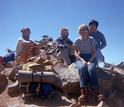
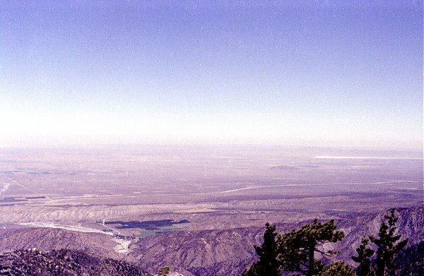
Mount San Gorgonio is one of the three 10,000 foot peaks in the Los Angeles area. I talked three Graduate School officemates into accompanying me and my father up the mountain.
| We started at Camp Angelus. Tony and I took the car on to Aspen Grove and then
hitchhiked back, while the others started up. It took longer than we expected to get
back, so we really had to hurry to catch up with the rest of the group. We spent the night near Limber Pine Bench, and the next day climbed San Bernadino Peak. From there, we hiked along the ridge, with wonderful views in all directions. Pictured are Charlie, Dave, Deb, and Tony. |
|
|
Hiking Party on San Bernadino Peak |
|
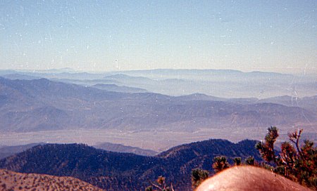
From the top of San Gorgonio the view facing south is spectacular. In the foreground is San Gorgonio Pass, Banning, and I10, 8000 feet below. On the far side of the pass is the range of mountains containing Mt. San Jacinto, another of the 10,000 foot peaks. | |
South from Mt. San Gorgonio |
|
The trail to Whitewater Canyon is described in Robinson's San Bernadino Mountain Trails, hike
61. In May it was hot and dry. I made this trip with my father, and we had to
hike the last couple of miles of dirt road, since we could not get our car up it.
Once we got to the ridge and dropped into the canyon we enjoyed the cool shade. This is the view from the ridge, looking down into Whitewater Canyon. Mt. San Gorgonio is behind. |
|
Whitewater Canyon and Mt. San Gorgonio |
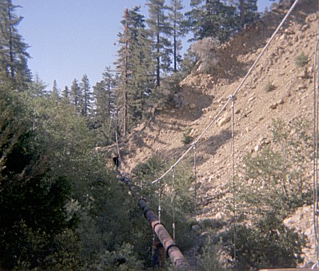
| We found the Aqueduct described in Robinson. I had expected some scant remains,
but we found an actual working flume, filled with water. (This was in 1976.
Is it still there ?) We followed the flume for miles. The wonderful thing is that it is almost flat. Much of it was covered loosely with wooden planks (as shown here) but lots of it is open. We could hear the water rushing by either way.
|
|
|
Aqueduct in Whitewater Canyon |
|
I greatly desired to see where the water was coming from, so we followed
the flume quite a ways. This is what we found. The pipe here leads directly
into the flume on one side, and on the other it connects to a little basin formed by
damming up a little stream coming down the mountain. Someone was still putting some
effort to maintaining this thing ! We hiked back along the flume, and down into the canyon, where we camped for the night. The next morning we explored upstream until we found Silverwood Falls. Along the way, we saw a bear, who seemed as surprised to see us as we were to see him. This was the first time I had seen a bear in Southern California.
|
|
Water Works -- Whitewater Canyon |
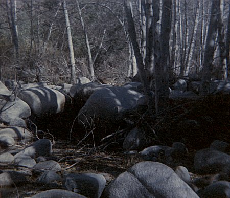
Robinson describes two hikes, 56 and 59, into the San Gabriel Wilderness. I decided to combine these two out-and-back hikes into a loop. Previously, I had been on both trails, but I was intrigued by the large blank space between them.
Devils Canyon trail starts across from Chilao, on the Angeles Crest Highway, and descends 1500 feet to the canyon below. Chilao was the site of my very first camping trip with my father, when I was probably about 6 years old. I remember being extremely cold at night: it was probably a combination of my thin sleeping bag and the cold weather. I also remember getting stuck by a yucca plant, my first encounter with that plant.
| The trail leads down to the canyon floor and ends. Walking along the canyon
bottom upstream was slow but not especially difficult. This photo shows a typical
section. Downstream the canyon narrows and a number of waterfalls block the way. But upstream, the canyon floor is not steep, although it was cluttered with brush. I saw few signs of other people in the canyon upstream from the trail. A few miles up, I found a big area of trampled-down material, like some big animal was living there. Do deer make this kind of "nest"? I still don't know what to make of it. |
|
|
Devils Canyon |
|
I made it most of the way up the canyon that day, and I camped out as the canyon was opening up. As you can see here, the ground cover is considerably more open, and the forest has changed to pine. | |
Upper Devils Canyon |
| As I got closer to the Twin Peaks saddle, I ran into snow cover. I was
surprised, because there was no sign of snow at Chilao. I have later discovered that
the north slope of Twin Peaks is often snow covered when there is little snow
elsewhere. I struggled up through snow, breaking through the thick crust, sometimes up to my hips. It was extremely tiring, but I was determined to reach the viewpoint. |
|
|
Twin Peaks Saddle |
|
The view was somewhat disappointing because of the cloud cover. This
photo was taken from the West peak, and shows the East peak, and the steep South slope. Getting back down through the snow was even more difficult, which was softening in the afternoon sunlight. I was relieved to get to the saddle and almost jogged the last five or six miles to the road. |
|
Twin Peaks |
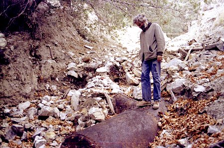
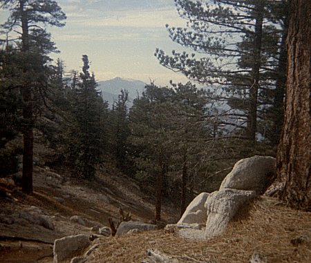
My interest was drawn to Iron Mountain because it was the most remote and most difficult area to get to in the whole San Gabriel Mountains (Robinson hike 86). On this, the first attempt, I was planning to take two days, carrying my backpacking gear as high as possible on the mountain, then climbing the rest of the way the next day and returning that same afternoon.
| The trail leads steeply up to an exposed ridge (no shade) and then up the ridge all
the way to the top. The discouraging part is that the ridge is steep, but goes
steeply down as well as up. After a few miles, at a saddle, there is a fork in the trail. Iron Mountain is up the ridge -- which at this point is extremely steep uphill. Or ... there is Allison Mine, whose trail roughly follows the contours around the side of the mountain. It was extremely hot, and I was just drinking the last of my water as I got to the saddle, so I had little choice to make Allison Mine my destination. It was quite a struggle to get to the mine with a backpack because the trail was so overgrown. The cool water and the shade revived me, and I had lots of fun exploring the mine and its vicinity. These tracks led to the mine entrance (behind) and to an ore hopper (just ahead). |
|
|
Ore Hopper -- Allison Mine |
|
I had thought that I could make another attempt at Iron Mountain from Allison Creek the next day. But the view up the canyon convinced me against trying that. | |
View Up Allison Canyon |
| The guidebook said that the miners had made a trail up Allison Canyon from the East
Fork below. Although it did not show up on the map, and was not recommended in the
book, I had suffered so on the hike in that I was determined to descend directly down
Allison Canyon. I managed to find remnant s of the trail in places. The most
critical was a section high up the canyon wall, bypassing some very steep waterfalls
below. Here is what the "trail" looked like. (It goes to the left of the
yucca plant in the center.) I made it to the bottom without encountering the severe difficulties reported by others. Once I was there, I headed up the canyon toward the Narrows. I wanted to see the "Bridge to Nowhere." |
|
|
Descending Allison Canyon |
|
During the Depression, the government decided to build a road up the East
Fork. It was to be a paved, two lane road. Because the slopes are so steep and
unstable, the road stayed hundreds of feet up from the river, high on the walls. At
the steepest, narrowest place, they built a magnificent concrete arch bridge across the
canyon. It originally went straight into a tunnel. Shortly after this bridge was completed, a disastrous flood washed out large parts of the road, even though it was way above the river bed. This convinced the government to abandon the project. This picture shows what is left: the tunnel has been filled in and the bridge goes nowhere. It is now miles from the nearest paved (or unpaved) road. |
|
East Fork Narrows Bridge |