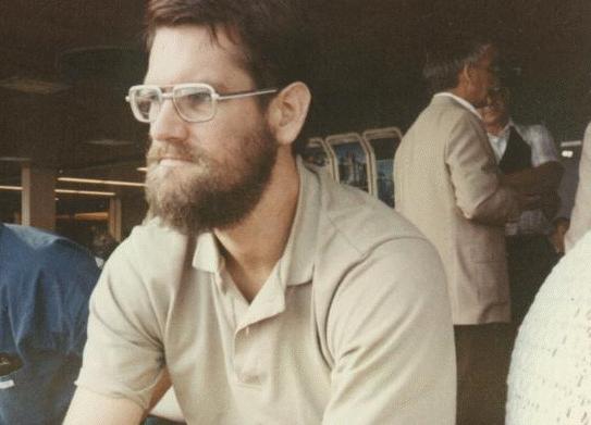
When I was a child in Southern California my father took by brother and me camping on a regular basis. There is so much to explore there -- the San Gabriel and San Bernadino Mountains, the Mojave, Anza Borrego, and Joshua Tree deserts, abandoned gold mines, derelict ruins, hidden lakes. And further away, the Southern Sierra.
When I think back on it, we did some outrageously risky things in those days, with my father and out of his sight. I am thinking of times when we hit a big rock and disabled the car miles and miles from the nearest highway (twice no less). Once the car froze and we waited all day for it to thaw (by dusk it was still frozen, and we had to start to walk). Or the time we went backpacking with no tents or even groundcloths, and it started pouring in the middle of the night, turned to snow, and six of us spent the rest of the night in an outhouse (standing room only).
 Miraculously, as
an adult my love of backpacking has remained with me. Alas, I am
now living in New Jersey. I have tried the Catskills, the Pine Barrens,
the Adirondacs.
They have never developed the hold on me that the Sierras still posses.
Even before I
moved East, when I was living in Los Angeles, I found it more
convenient to fly to Fresno
and take a bus to Sequoia than to drive. The trip is only a bit longer
from New Jersey. I
still find it amazing that I can leave home in the morning, get to
Fresno in the early
afternoon, get up to Sequoia before five, and be in the backcountry
that very evening.
Miraculously, as
an adult my love of backpacking has remained with me. Alas, I am
now living in New Jersey. I have tried the Catskills, the Pine Barrens,
the Adirondacs.
They have never developed the hold on me that the Sierras still posses.
Even before I
moved East, when I was living in Los Angeles, I found it more
convenient to fly to Fresno
and take a bus to Sequoia than to drive. The trip is only a bit longer
from New Jersey. I
still find it amazing that I can leave home in the morning, get to
Fresno in the early
afternoon, get up to Sequoia before five, and be in the backcountry
that very evening.
Over the years, I have taken my son and daughter, separately and together with their friends. I have gone with my father a couple times. But mostly I have gone by myself. I know this increases the risks, and it also increases the pleasures, but mostly it is forced upon my by circumstances. Maybe the WWW will help me to find companions to share these adventures with. If you are interested in joining me, let me know.
The following pictures are a random selection from the many trips I have been on. It is amazing how feebly pictures convey the feeling of the mountains, and how much less they would mean to someone who cannot link them to the memory of actually being there. If you have ever explored the backcountry of Sequoia/Kings Canyon, maybe some of these pictures will stir your memories.
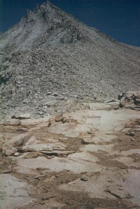
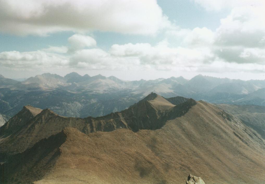
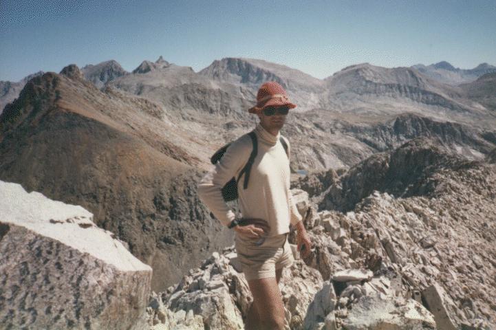 The gulf between
picture and memory is especially true of pictures taken from the
highest peaks. Here I am on the ridge just below Triple Divide Peak. It
seems like sheer
cliffs on both sides. I have not seen another hiker in days, and am
feeling pretty
nervous. The picture makes it look pretty easy, right ?
The gulf between
picture and memory is especially true of pictures taken from the
highest peaks. Here I am on the ridge just below Triple Divide Peak. It
seems like sheer
cliffs on both sides. I have not seen another hiker in days, and am
feeling pretty
nervous. The picture makes it look pretty easy, right ?
 On the other hand,
sometimes the pictures can capture the feeling. Here I have
just come through a pass that was pretty gentle on one side, and face a
huge cliff on the
other. This is Vennacher Needle (or something in the vicinity - I was
never quite sure). I
made it down, but it took me several hours to regain my composure after
that.
On the other hand,
sometimes the pictures can capture the feeling. Here I have
just come through a pass that was pretty gentle on one side, and face a
huge cliff on the
other. This is Vennacher Needle (or something in the vicinity - I was
never quite sure). I
made it down, but it took me several hours to regain my composure after
that.
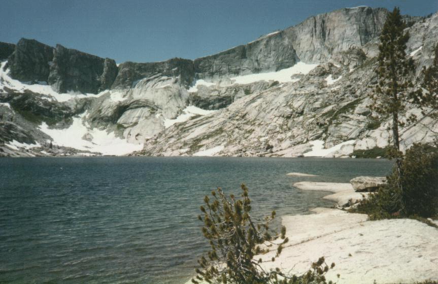
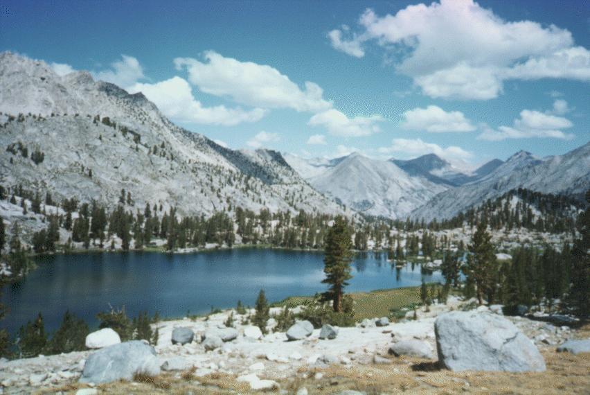
 I have explored
most of the territory in the Sequoia/Kings Canyon park system, on
trail and off. One of my favorite places has always been Table Meadows,
above Pear Lake.
It is one of the easiest places to get off the trails, into the real
wilderness. It is
relatively flat, treeless, with good landmarks for easy navigation. And
it is beautiful,
with many lakes and vistas. Because it is near the popular Pear Lake
trailhead, it has
gotten more and more common to see other travelers there over the
years. This lake, at the
headwaters of Big Bird Lake, is a favorite stopping place on my way
out.
I have explored
most of the territory in the Sequoia/Kings Canyon park system, on
trail and off. One of my favorite places has always been Table Meadows,
above Pear Lake.
It is one of the easiest places to get off the trails, into the real
wilderness. It is
relatively flat, treeless, with good landmarks for easy navigation. And
it is beautiful,
with many lakes and vistas. Because it is near the popular Pear Lake
trailhead, it has
gotten more and more common to see other travelers there over the
years. This lake, at the
headwaters of Big Bird Lake, is a favorite stopping place on my way
out.
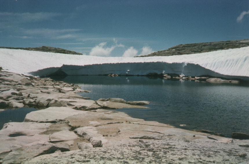
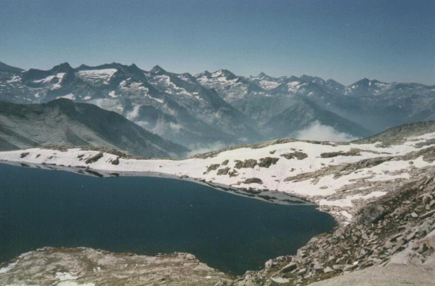
 Where the previous
picture show the lake and the gentle Table Meadows on a sunny
day, this picture shows the same lake, which is perched just on the
edge of tremendous
cliffs at 11,000 feet, as a storm is coming in. It is hard to get a
sense of scale in
these photographs. Can you see the tent in the center of this picture ?
Where the previous
picture show the lake and the gentle Table Meadows on a sunny
day, this picture shows the same lake, which is perched just on the
edge of tremendous
cliffs at 11,000 feet, as a storm is coming in. It is hard to get a
sense of scale in
these photographs. Can you see the tent in the center of this picture ?
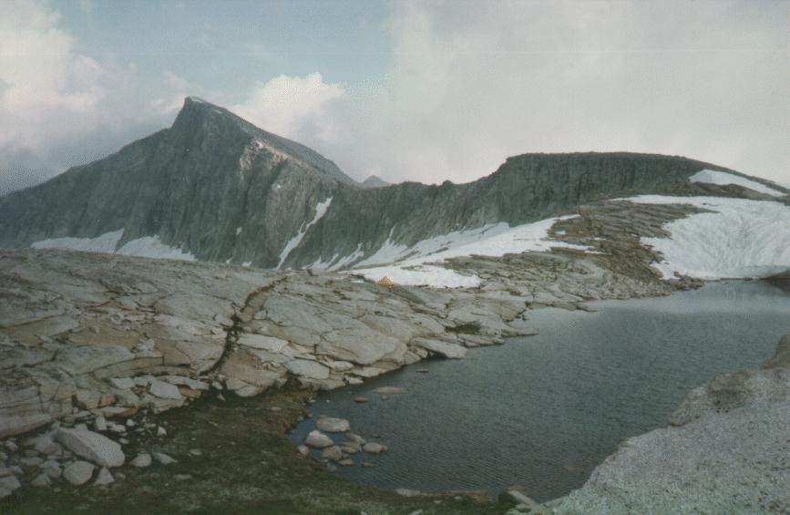
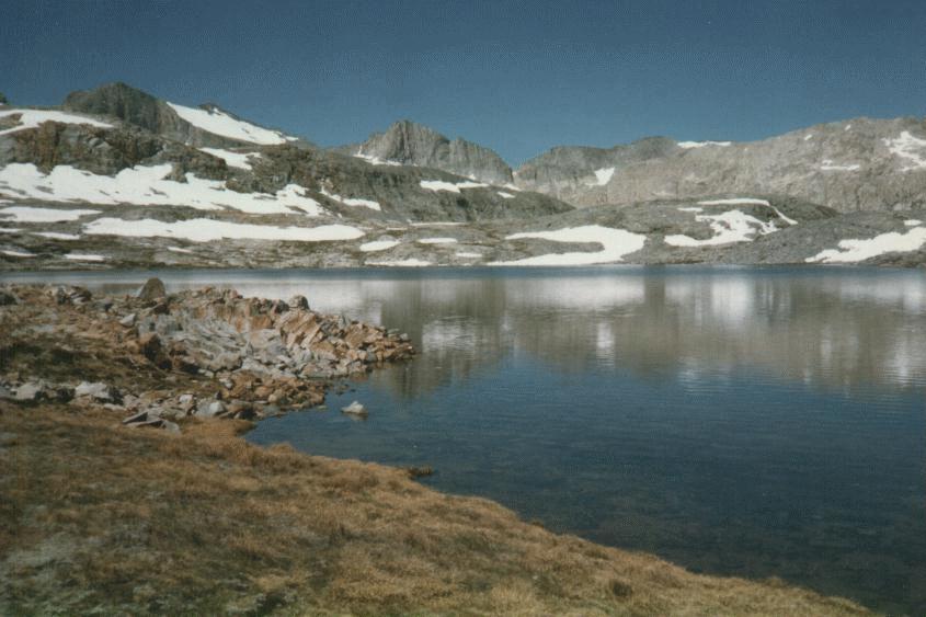
 This shows more
clearly the view of the cliffs surrounding Big Bird Lake,
separating Table Meadows from the more rugged country to its East. The
view is of Big Bird
Lake, which is just a little ways off the Elizabath Pass trail and
another very popular
destination for off-trail hikers.
This shows more
clearly the view of the cliffs surrounding Big Bird Lake,
separating Table Meadows from the more rugged country to its East. The
view is of Big Bird
Lake, which is just a little ways off the Elizabath Pass trail and
another very popular
destination for off-trail hikers.
 One of the most
memorable trips I took as a child, and perhaps the one that got
me hooked on backcountry travel, was a trip with my father, brother,
and several other
kids from the neighborhood. We started by climbing Mt Whitney, and
continued across the
Pacific crest trail to Giant Forest. Our ignominious fiasco in the
outhouse was actually
in preparation for this expedition. (We added a tarp, but still no tent
to our gear.)
After crossing the Kern River, and consulting with a ranger, my father
decided to take a
short cut across the Great Western Divide, which involved some off
trail hiking and
getting through a class 2 pass (Pants Pass). I still remember the
thrill of going where
there was no trail or sign that anyone else had been here. The pass
itself still scares
me. I have never again had the courage to plan a trip that required me
to climb it with my
pack, although I have climbed u one side or the other with a day pack.
The lake pictured
here sits among weirdly-colored rock, which the photo labs have no idea
how to print and
which always coming out far from the right color in pictures.
One of the most
memorable trips I took as a child, and perhaps the one that got
me hooked on backcountry travel, was a trip with my father, brother,
and several other
kids from the neighborhood. We started by climbing Mt Whitney, and
continued across the
Pacific crest trail to Giant Forest. Our ignominious fiasco in the
outhouse was actually
in preparation for this expedition. (We added a tarp, but still no tent
to our gear.)
After crossing the Kern River, and consulting with a ranger, my father
decided to take a
short cut across the Great Western Divide, which involved some off
trail hiking and
getting through a class 2 pass (Pants Pass). I still remember the
thrill of going where
there was no trail or sign that anyone else had been here. The pass
itself still scares
me. I have never again had the courage to plan a trip that required me
to climb it with my
pack, although I have climbed u one side or the other with a day pack.
The lake pictured
here sits among weirdly-colored rock, which the photo labs have no idea
how to print and
which always coming out far from the right color in pictures.
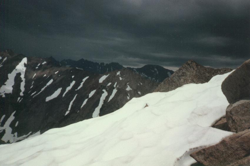 For me one of the scariest parts of hiking, apart from falling, is
getting caught in a
storm. I have plenty of pictures of rain and hail storms, which just
look like fog, like
everything is out of focus. This picture, taken on Sawtooth Pass in the
Mineral King area
in a year of very heavy snowfall, shows a storm approaching from the
East. I had seen
dozens of hikers on the way up, but they all took off as the storm
approached, and I had
the trail to myself for the next three days. On the other hand, the
thunder and lightning
continued for the whole trip, and I cursed myself over and over again
for getting in such
a situation.
For me one of the scariest parts of hiking, apart from falling, is
getting caught in a
storm. I have plenty of pictures of rain and hail storms, which just
look like fog, like
everything is out of focus. This picture, taken on Sawtooth Pass in the
Mineral King area
in a year of very heavy snowfall, shows a storm approaching from the
East. I had seen
dozens of hikers on the way up, but they all took off as the storm
approached, and I had
the trail to myself for the next three days. On the other hand, the
thunder and lightning
continued for the whole trip, and I cursed myself over and over again
for getting in such
a situation.
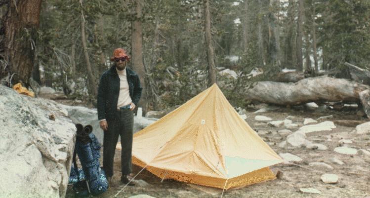 I do carry a tent, although some would consider that a sissy thing to
do. It gives me
great peace of mind at night when the weather looks threatening, it
comes in handy when
there are lots of bugs out, and I can pitch the fly without the tent in
the middle of the
afternoon to take a nap out of the sun above the tree line. This is a
great little tent,
now almost 20 years old.
I do carry a tent, although some would consider that a sissy thing to
do. It gives me
great peace of mind at night when the weather looks threatening, it
comes in handy when
there are lots of bugs out, and I can pitch the fly without the tent in
the middle of the
afternoon to take a nap out of the sun above the tree line. This is a
great little tent,
now almost 20 years old.
![]() For a few years it
was my ambition to climb the most prominent peaks in the area.
On my very first trip, mentioned above, I had gotten a good look at
Triple Divide Peak,
and had passed by it on several sides, and I determined to climb it.
The first two times I
tried I got close, but chickened out. My nerves just gave out. Now I
realize it was a
combination of exhaustion and altitude sickness that was making my
heart race, but I find
it is impossible for me not to interpret these as signs of terror. Now
I try to put the
more strenuous climbing later in the trip. I eventually made it up
Triple Divide Peak, as
shown in an earlier photo. This picture shows Arrow Peak, with Bench
Lake in the
foreground. I climbed up the pass to the left of the peak, camped just
beyond the pass,
and climbed the slope on the left the next day. Tremendous views all
around. More
memorable was Arrow Canyon, which I followed out to Paradise Valley.
This is one of the
remotest spots I have visited. I encountered a couple near the
headwaters of Arrow Creek,
who told me they had been coming to this same valley every year for
over 20 years, and I
was the first person they had ever met there. They graciously told me
how to get down the
cliffs at the left -- I am not sure I could have done it otherwise.
For a few years it
was my ambition to climb the most prominent peaks in the area.
On my very first trip, mentioned above, I had gotten a good look at
Triple Divide Peak,
and had passed by it on several sides, and I determined to climb it.
The first two times I
tried I got close, but chickened out. My nerves just gave out. Now I
realize it was a
combination of exhaustion and altitude sickness that was making my
heart race, but I find
it is impossible for me not to interpret these as signs of terror. Now
I try to put the
more strenuous climbing later in the trip. I eventually made it up
Triple Divide Peak, as
shown in an earlier photo. This picture shows Arrow Peak, with Bench
Lake in the
foreground. I climbed up the pass to the left of the peak, camped just
beyond the pass,
and climbed the slope on the left the next day. Tremendous views all
around. More
memorable was Arrow Canyon, which I followed out to Paradise Valley.
This is one of the
remotest spots I have visited. I encountered a couple near the
headwaters of Arrow Creek,
who told me they had been coming to this same valley every year for
over 20 years, and I
was the first person they had ever met there. They graciously told me
how to get down the
cliffs at the left -- I am not sure I could have done it otherwise.
 This is the south
face of Mt Brewer. As a boy I had read William H. Brewer's
account of climbing this peak, and had made up my mind to climb it. The
first time I tried
I was turned back by a forest fore in Cloud Canyon, although later the
ranger laughed at
me for not just walking through it. (It was burning the whole width of
the valley. Why did
they not mention it when I got my backcountry permit ?) The second time
several years
later I got to within 100 feet when a gigantic electrical storm chased
me off the peak.
This view of the route up the South face looks easy, but it is still
1500 feet to go.
This is the south
face of Mt Brewer. As a boy I had read William H. Brewer's
account of climbing this peak, and had made up my mind to climb it. The
first time I tried
I was turned back by a forest fore in Cloud Canyon, although later the
ranger laughed at
me for not just walking through it. (It was burning the whole width of
the valley. Why did
they not mention it when I got my backcountry permit ?) The second time
several years
later I got to within 100 feet when a gigantic electrical storm chased
me off the peak.
This view of the route up the South face looks easy, but it is still
1500 feet to go.
 This picture was
taken on top of Marion Peak. I used the timer on my camera to
take most of these pictures. Pictures from the top look so
unimpressive, but I just cannot
help including one.
This picture was
taken on top of Marion Peak. I used the timer on my camera to
take most of these pictures. Pictures from the top look so
unimpressive, but I just cannot
help including one.
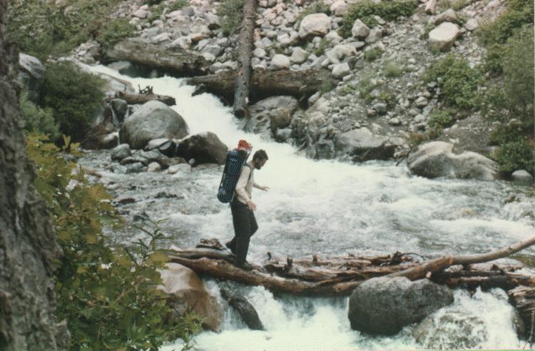 Although the
danger of falling off a cliff or otherwise becoming incapable of
travel are the greatest threat to solo hiking, I tend to spend more
time worrying about
stream crossings. This is probably a result of another experience with
a flooding stream
in the San Gabriels. Unless you have experienced it, it is truly hard
to understand how
hard it is to remain upright in rushing water as shallow as
knee-height. I sat beside this
particular stream (Cliff Creek) for half an hour contemplating whether
to try the logs or
try to wade across elsewhere. I actually made it across without getting
wet! Most major
stream crossings in Sequoia/Kings Canyon have bridges, and the
crossings in the high
country are not nearly so difficult.
Although the
danger of falling off a cliff or otherwise becoming incapable of
travel are the greatest threat to solo hiking, I tend to spend more
time worrying about
stream crossings. This is probably a result of another experience with
a flooding stream
in the San Gabriels. Unless you have experienced it, it is truly hard
to understand how
hard it is to remain upright in rushing water as shallow as
knee-height. I sat beside this
particular stream (Cliff Creek) for half an hour contemplating whether
to try the logs or
try to wade across elsewhere. I actually made it across without getting
wet! Most major
stream crossings in Sequoia/Kings Canyon have bridges, and the
crossings in the high
country are not nearly so difficult.
 The amount of snow in the Sierra Backcountry varies greatly year to
year. This particular
year there was a lot of snow. As you can see, I came prepared with an
ice axe. I didn't
really have to use it much, but it gave me a great feeling of security
crossing the many
snow and ice fields covering the trail. Unfortunately I was with my
father this particular
year, and he did not bring anything he could use in this way, and
besides his boots were
smooth and slippery. I was greatly concerned for his safety. I can see
now that I should
have insisted he use the ice axe, as I was better able to get across
without it. Luckily
nothing bad happened.
The amount of snow in the Sierra Backcountry varies greatly year to
year. This particular
year there was a lot of snow. As you can see, I came prepared with an
ice axe. I didn't
really have to use it much, but it gave me a great feeling of security
crossing the many
snow and ice fields covering the trail. Unfortunately I was with my
father this particular
year, and he did not bring anything he could use in this way, and
besides his boots were
smooth and slippery. I was greatly concerned for his safety. I can see
now that I should
have insisted he use the ice axe, as I was better able to get across
without it. Luckily
nothing bad happened.
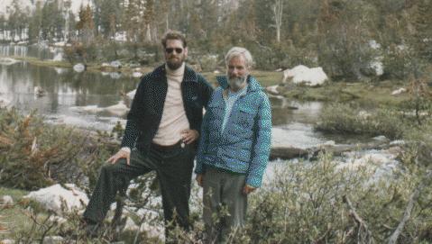 Here I am with my
father. About 3 days out we met about the only other people we
would see all week, and we got them to take this picture of us.
Here I am with my
father. About 3 days out we met about the only other people we
would see all week, and we got them to take this picture of us.
 I took my daughter
Carrie (right) and her friend Eva. They were about twelve at
the time, and enjoyed the experience, but have not agreed to go again.
We spent about a
week in the Tablelands, exploring the many lakes and meadows there. The
girls never tired
of turning over rocks, exploring around, hunting for marmots
and pikas,
and wading in the lakes.
I took my daughter
Carrie (right) and her friend Eva. They were about twelve at
the time, and enjoyed the experience, but have not agreed to go again.
We spent about a
week in the Tablelands, exploring the many lakes and meadows there. The
girls never tired
of turning over rocks, exploring around, hunting for marmots
and pikas,
and wading in the lakes.
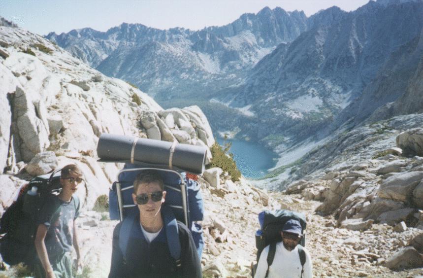 Another year, I took my son Ben (center). He brought his friend and his
dad, who had never
been backpacking before. Unlike the trip with the girls, this trip was
planned to be very
strenuous. Here we were headed up toward Mt Brewer from Reflection
Lake. We were
ultimately turned back by snow in a critical pass.
Another year, I took my son Ben (center). He brought his friend and his
dad, who had never
been backpacking before. Unlike the trip with the girls, this trip was
planned to be very
strenuous. Here we were headed up toward Mt Brewer from Reflection
Lake. We were
ultimately turned back by snow in a critical pass.
 The Kaweah Peaks Ridge is visible on the Southern horizon of the
Tablelands It is notable
because of the strongly colored rock in the higher elevations. Most of
the sierra is
granite -- a light colored, solid rock that is a pleasure to hike on or
scramble across
because of its good texture.
The Kaweah Peaks Ridge is visible on the Southern horizon of the
Tablelands It is notable
because of the strongly colored rock in the higher elevations. Most of
the sierra is
granite -- a light colored, solid rock that is a pleasure to hike on or
scramble across
because of its good texture.
The granite was formed deep underground, beneath a layer of older sedimentary rock. As the mountains formed, this older rock eroded away almost everywhere. Everywhere except the Kaweah Peaks. The rock here is red and black, and is much more brittle and breaks into sharp pieces. In this picture, taken from on top of Mt Kaweah, the surrounding ridges look pretty smooth. Up close they are a maddening expanse of boulders perched precariously to fall on you with the slightest provocation.
 Lonely Lake, its
name noted only on the newest series of topo maps, is another
one of my favorite places. I had seen it on the map, and had thought
about going by it for
years before actually doing it. I have never seen anyone else there,
not even a footprint.
But it is actually on a good cross-country route into the Deadman/Cloud
canyon territory.
There is significantly less elevation loss and gain than going by Big
Bird Lake, the other
alternative.
Lonely Lake, its
name noted only on the newest series of topo maps, is another
one of my favorite places. I had seen it on the map, and had thought
about going by it for
years before actually doing it. I have never seen anyone else there,
not even a footprint.
But it is actually on a good cross-country route into the Deadman/Cloud
canyon territory.
There is significantly less elevation loss and gain than going by Big
Bird Lake, the other
alternative.
 Moose lake was the
destination for my very first cross-country solo backpacking
experience. It is only a few miles from the end of the trail at Pear
Lake, and the route
is described in the popular trail guides. I think more people come
cross-country than get
there by the trail. When I was younger I could get to Moose Lake and
beyond on the first
hiking day. Now I stop short of it on my first day. It is one
undeniable sign that I am no
longer as strong as I once was.
Moose lake was the
destination for my very first cross-country solo backpacking
experience. It is only a few miles from the end of the trail at Pear
Lake, and the route
is described in the popular trail guides. I think more people come
cross-country than get
there by the trail. When I was younger I could get to Moose Lake and
beyond on the first
hiking day. Now I stop short of it on my first day. It is one
undeniable sign that I am no
longer as strong as I once was.
 Rae Lakes is one of the most popular and heavily-traveled areas in
Kings Canyon. I had
avoided it for 20 years. But one time I had to alter my original plans
because I could not
make it over a pass I had planned to cross, and so I decided to do Rae
Lakes. They were as
spectacular as anything I have ever seen. I sat in the pass just
looking down on them,
taking in their breathtaking beauty. Alas, we passed at least two dozen
campsites, each
taken by one or two parties. At last we found an empty spot to put up
our tent, just
before a tremendous storm dumped a few inches of sleet on us.
Rae Lakes is one of the most popular and heavily-traveled areas in
Kings Canyon. I had
avoided it for 20 years. But one time I had to alter my original plans
because I could not
make it over a pass I had planned to cross, and so I decided to do Rae
Lakes. They were as
spectacular as anything I have ever seen. I sat in the pass just
looking down on them,
taking in their breathtaking beauty. Alas, we passed at least two dozen
campsites, each
taken by one or two parties. At last we found an empty spot to put up
our tent, just
before a tremendous storm dumped a few inches of sleet on us.
